


Lupine Publishers Group
Lupine Publishers
ISSN: 2637-4676
Research Article(ISSN: 2637-4676) 
The Effect of Planetary Orbital Motions on The Rises of Rift Valley Lake Levels in East Africa Volume 10 - Issue 2
Received: September 29, 2022; Published: October 17, 2022
Corresponding author: Roger Ndichu (rogerndichu@gmail.com)
DOI: 10.32474/CIACR.2022.10.000332
Abstract
Exceptionally high lake levels in East Africa have caused extensive disruption of the social and economic activities of the affected areas. Various studies suggest that global climate systems provide little evidence that link the lake rises and ENSO and IOD events in East Africa. Other studies have attributed the extreme lake levels to local hydrological, geological and seismological factors. However, this fails to explain conclusively why the events occur simultaneously across the region, and at certain intervals. This paper examines the relationship between high stands of the East Africa lakes and the astronomical orbital cycles of some of the planets of the solar system and explore whether these climate drivers could be of global nature. This study found that the extreme lake levels in the region are not only due to climatic factors but also astronomical factors. In the astronomical arena, identifying the years of observation of the conjunction of Uranus, the opposition of Saturn and the opposition of Jupiter, made it possible to determine periods of high lake levels. The planets Jupiter, Saturn and Uranus are associated with the 12-year, 30-year and 84-year drought /flood cycles respectively. Each cycle has a wet and a dry phase. Notably, the lake level elevations or extreme levels of the lakes normally occur during the overlapping wet phases of the 30-year and 84-year cycles. A similar scenario occurs with the overlapping wet phases of the 30-year and the 12-year cycles. Further, the overlapping wet phases of the 12-year, 30-year and 84- year cycles were associated with periods of phenomenal flooding events, high lake levels and exceptionally high amounts of rainfall in many areas of East Africa. It is projected that the lake levels that started in 2019 are likely to last into 2022 and may come again in around 2039. Further, these extreme cases may be experienced between 2045 and 2074. It is recommended that meteorological patterns and astronomical cycles should be carefully monitored and validated to provide possible simulation of future lake level scenarios.
Keywords: Planetary orbital motions; Rift Valley Lake rises; East Africa; El Nino; high stands
Introduction
Lakes high stands in East Africa are rare events that have occurred periodically over many centuries. They are characterized by rising water levels which affect communities living around the lakes or riverbanks often causing adverse social and economic losses as experienced in 1961-1962 [1]. These occurrences can involve the ‘permanent’ uprooting of whole communities and these communities only go back to their land after the water levels subside, which may take a long time to happen [2-4]. High and low Lake Levels are not new in the African lakes and their fluctuations have been associated with geological, climatic, and other environmental causes [5-8]. In particular, water levels have been rising in most of the Rift Valley lakes in Kenya with exceptional levels in 2019- 2020 [9]. There is concern that increasing lake waters are unpredictably enlarging most of the lakes with a likelihood of some of them merging in future. Some of these lakes include Lake Nakuru and Lake Elementaita; and Lake Bogoria and Lake Baringo [10]. There is a plethora of studies which show that high lakes stands in Kenya are historical. For example, in 1930, a scientific expedition by the Cambridge University examined Lake Turkana and Baringo when the country had received “abnormally heavy rainfall” between 1929 and 1930 [11]. Similar occurrences were observed in the early 1960s leading to further investigations [1,2]. In the past, certain high lake stands were exceptional in terms of duration and severity yet others showed usual periodical fluctuations. Vincent et al. (1979) Studied the lake levels of Lake Naivasha for the period 1880-1975 and found that they showed inter annual variations similar to those of Lake Victoria, a pattern replicated in a subsequent period (Stager et. al., 2007). Nicholson (1998) also found that the East Africa Rift valley lakes were at low levels between 1900 and 1950 and thereafter higher levels until the end of the 19th century. Although much focus has been on Rift Valley lakes in the recent past, other lakes in the region have exhibited similar patterns during the 2011-2020 period [15]. Which suggests that global drivers may be associated with the changes relative to local factors. Rainfall in East Africa is mainly controlled by the Inter- Tropical Convergence Zone (ITCZ). El-Nino Southern Oscillation (ENSO) and Madden-Julian Oscillation (MJO) are also considered as key drivers of rainfall occurrences. Ironically, rainfall extremes have not been well understood in the region leading to assumptions of Climate Change in the climate systems where more intense and frequent droughts and flooding have occurred [16,17]. Numerous schools of thoughts have been considered regarding the causal factors of the lake level rises. These are discussed in the next two sub-sections.
Causes of the High Lake Stands
the early 1960s, the flooding events and extreme lakes levels and the damage to infrastructure raised major concerns to the government of Kenya. Various investigations were conducted initially [1,14,18-20] to address the problem. Generally, most of these studies highlighted that the occurrence of exceptional rainfalls in the catchments was the main driver of the high lakes stands in Kenya. Rainfall records from the Kenya Highlands areas are highly correlated with the increases in the Eastern African Rift Valley lakes levels [21]. A hypothesis highly supported by most studies and reports including Nicholson et al. (1997) and KWTA (2015). Onywere et al., (2013) Further suggests that the lake level rises have a 50-year cycle based on the flooding incidences of 1901 and 1963. Many of the analyses have been inconclusive with some unexplained outcomes [22]. Contrastingly, other studies have suggested that the global climate systems offer little evidence linking the lake rises and the ENSO and IOD events in Kenya (Stager et al, 2007; Nicholson et. al., 1997; Saji et. al., 1999). Saji et al., (1999) Showed that IOD mode accounts for about 12% of the sea surface temperature variability in the Indian Ocean and, in its active years causes severe rainfall in eastern Africa. Yet other studies mention land-use, land-cover, hydrological, geological and seismological factors as the main drivers of the lakes levels fluctuations [21,25- 29]. In general these arguments are subjective and not based on empirical observations. Other reports indicate that above normal rainfall and the cumulative impact of seasonal rainfall over several years in the lake basins led to increased river flows, storm runoff, and rise in groundwater table and discharge from springs leading to rises in the lake levels [9,10,15]. Climate Change also have widely been seen to have certain anthropogenic influences that altered the catchment hydrology of the lakes [9,15,30].
Solar Forcing and Planetary Orbital Motions
Astronomically related studies that explain the causes of lake level rises are not given much attention and often are met with a lot of skepticism [23,31-33]. Knowing about other drivers different from ENSO and IOD systems may improve our understanding of how celestial perturbations and solar system variations influence rainfall and increasing lake levels in East Africa. [34] Studied sedimentological and geochemical characteristics of Lake Magadi and showed that climate fluctuated in cycles related to the sunspot cycles of ~11 years and ENSO cycles of ~ 3 ½ years. One of the cycles singled out in this study is the 30-year cycle and that a cyclic astronomical phenomenon regulates the climate. Nile floods and the Ethiopian rainfall display significant ∼11‐year periodicities [35,36]. The 10-15 year and 30-year rainfall cycles have been reported in different parts of the globe (Lamb, 1972; Halmova et. al., 2015; Gray et. al., 2004; Wang et. al., 2010; Wang and Gillies, 2012; Naidu, 1999), Pointing towards drivers of global nature. Solar cycles of ∼88 and ∼200‐year durations also occur in the Nile flood records. The ~88-year cycle can be compared to the ~80-year cycle used by Gleissberg (1971) for solar activity forecasting. The 200- year duration can also be associated with the Suess /de Vries 207- year cycle. All the cycles are related to long-term changes in solar activity and climate change [43]. The use of the Sunspot numbers was first done by Brooks (1923) to describe the link between the levels of Lake Victoria and the sunspots associated with the ∼11‐ year cycle. Initially, [44] showed that there was a link between the lake surface levels and sunspot numbers. Nonetheless, weak association was shown in the subsequent period [45]. In spite of the weak association between lake levels and sunspot numbers, many researchers have pursued the same over the years as demonstrated by Yousef and Amer (2003); Stager et. al (2005); Cohen et. al (2006); Stager, et al ( 2007); and Ndichu (2019). Consequaently, Stager et al., (2005) Shows a close association of solar maxima with Lake Victoria level pulses and similarly in at least five other East African lakes. This suggests that there exists a sunspot-rainfall relationship at the regional scale, and this is supported in [47]. [48] Showed that the orbital motions of some planets of the solar system: Venus, Jupiter, Mars, Saturn and Uranus have a relationship with rainfall in Kenya in cycles of 8-years, 12- year, 15-year, 30-year and 84 years’ durations respectively. The 12-year, 30-year and 84-year cycles seem to be the most dominant as they explain the highest variation of rainfall in the region. These are the cycles captured in the 10- 15 year, 30-year and 80-year rainfall cycles in [37-42]. As indicated earlier, over the years, most of the proposed causative factors of the lakes high stands in East Africa have been inconclusive. The proposed factors are local in nature, where for instance ENSO, seem to influence flooding in certain areas leaving out others in the same geographical space. Since, the behavior of global nature affects nearly all lakes in the region, at the same time (e.g. the 1961- 1962 flooding event), the problem calls for a different approach to understanding the causes of extreme lake level rises in the region.
From the aforementioned, the aim of this study is to evaluate the relationship between celestial perturbations and the high stands of lakes in East Africa.
The specific objectives are:
a) Generating a chronology of historical lake level extreme events in East Africa.
b) To analyse the astronomically generated rainfall cycles in [47]. and the associated “wet” periods and “very wet” periods.
c) To examine the link between the wet phases of the rainfall cycles and the extreme lake levels and particularly the periods of overlap of the wet phases; and
d) To examine the role of the ENSO events during the dry and wet phases of the rainfall cycles.
Methodology
Study Area
The study focuses on East Africa [Latitudes 6° N 5’ 48.7” and 11° S 59’ 46.8” and Longitudes 41° E 49’ 32.38” and 28° E 45’ 22.5”] (Figure 1). The study also considers the basin area of the Nile River which extends outside our target area to areas that include Sudan, South Sudan and Ethiopia since the Nile River starts from Lake Victoria as the White Nile and flows north through South Sudan and Sudan, converging with the Blue Nile before it flows north to the Mediterranean Sea. The source of the Blue Nile is Lake Tana in the highlands of Ethiopia. The major lakes in East Africa are found in Kenya, Uganda, Malawi, Tanzania, Burundi and Rwanda. While East Africa may not include countries like Ethiopia and Somalia, these other countries seem to also share similar patterns in the occurrence of extreme climate in the region [4]. The study region has a wide range of distinctive terrain features including the highlands, mountain ranges, lakes, rivers, swamps and wetlands, lowland plains and the Rift Valley [49-51]. The Rift Valley is a major physical feature that runs in the North-South direction It is divided into the Western Rift and the Eastern Rift. The Western Rift runs along the border of the region with the Democratic Republic of Congo and contains a series of deep-water lakes that run along its valley such as Lake Tanganyika, Lake Kivu, Lake Malawi, Lake Edward and Lake Albert [52,53]. The Eastern Rift has lakes which consist of Lakes Naivasha, Nakuru, Bogoria, Baringo and Turkana, amongst other lakes, which are not the distinctively deep-water lakes of the western branch. They lie in a wide valley and are quite shallow and without outlets (Figure 1). East Africa experiences a biannual rainfall mode that results in annual rainfall of between 800mm and 1200mm divided between two major rainfall seasons: March to May or MAM, and also known as the ‘long rains’, and October to December (OND) or ‘short rains’ [16,54]. Rainfall in the region is mainly controlled by the Inter-Tropical Convergence Zone (ITCZ) and is strongly influenced by many global systems including the ENSO phenomenon (WMO, 2013), the Quasi-Biennial Oscillation (QBO), the Indian Ocean Dipole (IOD), easterly waves and the Madden Julian Oscillation (MJO) [16,55].
Figure 1: Map of the major lakes in East Africa.

Data and Methods
Astronomical Data
Astronomical data comprised of the positions of specific planets of the solar system in reference to the Earth and the Sun and is given as dates of occurrence or observation of the planets position from the Earth. Of particular interest are the dates of opposition phases of the planets Saturn and Jupiter (observed in January) and the Conjunction of the Uranus with the Sun. The Opposition phase of a planet is a moment when the earth is between a planet and the Sun, all in a single axis. Conjunction of Uranus is the moment when Earth is between planet Uranus and the Sun, all in a single axis. The dates of observation of the opposition phases of all the planets Uranus, Saturn and Jupiter were obtained from the NASA-Jet Propulsion Laboratory (JPL) (Folkner et. al., 2014) and were sourced from the JPL Horizons Ephemeris for the period ca. 1690 to 2080.
Rainfall Data
The rainfall cycles were generated from the Ndichu (2019) study where monthly rainfall anomalies data covering the region were obtained as Surface Precipitation Rate (mm/day). The data is an NCEP reanalysis and was Produced and generated at the NOAA/ESRL PSD. The data used ranged from 1948 to 2018. The rainfall cycle associated with a particular planet was determined by calculating the average rainfall anomalies (mm/day) from the opposition phase to the next opposition phase of an orbital position of a planet when observed in the month of January.
Determination of Rainfall Cycles
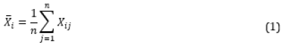
From Ndichu (2019), analysis of the rainfall variations tended to repeat every time a planetary phase is observed in the same month of the year. This can be some years apart and thus constitutes a rainfall cycle. For example, the planet Jupiter at Opposition phase in January 1943, had the next Opposition phase in January 1954, which are 12 years (144 months) apart and this is a rainfall cycle associated with Jupiter. If i is the month in the cycle, January 1943 would be i=1 and the end of the cycle would be December 1953, i=144. Given a rainfall dataset from a zone or station and designated as 𝑋ij, X is the total monthly rainfall value, 𝑖 is the month of the cycle (satisfying the condition e.g 1 ≤ 𝑖 ≤ 144, for Jupiter, and 𝑗 is the year under consideration with n being maximum number of years in the dataset (e.g. 1948 − 2017, 𝑛 = 69). The average rainfall value for month i for all n years in the cycle is given in Equation (1)
if we take all the years when opposition phase of a planet 𝜓 is observed in January from the above dataset, n, and take it as the beginning of the rainfall cycle, then the rainfall average in month i when opposition phase of the planet 𝜓 is observed in January is given in Equation (2)
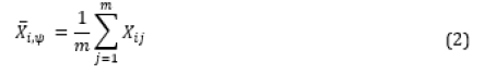
m is the number of cycles and 𝜓 is the associated planet.


A time series of the

Historical Data on Extreme Lake Levels
As the reanalyzed rainfall anomalies data begins in 1948, it was found necessary to use qualitative data on historical extreme climate in which case the extreme flooding and high lake levels were observed at a period when there were no meteorological records in the region. The qualitative data were targeted in the period 1690 to 1948, although this extended beyond 1948. The qualitative data comes in the form of a chronology of the lake level high stands sourced from qualitative reports and studies presented by various researchers and authorities in climate and lake level reconstructions using paleo climatological data proxies (e.g., Johnson, 1992; Nicholson, 1997; Verschuren, 2000) In which sediment stratigraphy was done in the lakes. This was further supplemented with available records on political or oral histories of communities living in the region or those living downstream the Nile. Nicholson’s (1997) Reconstructions of East African lake levels during this period and the Nile flood records. Notably, one of the indicators of the Lake Victoria overflow is the enormous flooding of the River Nile since it has a large storage source in the lake. To complement the above, actual rainfall totals from different sources, such as Kenya Meteorological Department data Archives and the Colonial Reports (1919, 1930), Were used to create climate scenarios of the past. Some of the sources of this information were the [3,57-60,74]. With all the data in place, the “wet” phases (and “very wet” segments) of the cycles of each planet were then examined for uniformity with periods of high lake levels. This entailed comparing the “wet” period of the cycle with the “high lake levels” period for consistency. From the results, we further determined the future periods of occurrence of expected extreme lake levels by using the rainfall cycles in which the “wet” and the “very wet” phases of the future were determined.
Results and Discussions
The chronology of the historical lake level high stands
The Lake high stands and floods of the 18th Century
The first documented evidence of high stands of Lake Victoria occurred around the 1720s [61]. It is reported that the River Nile flooded large swathes of the Kordofan plains and Bahr-el-Arab basin in Sudan, forcing out the Dinka, Naath and other communities living there [62]. Other records indicate that the Nile River was high from about 1715 [52]. Some other lakes had similarly high levels like Lake Edwards in Uganda, which maintained relatively high levels from 1710 to 1770 [63]. Lake Naivasha in Kenya had high stands in the 1720s and this may have continued to about 1740 [48]. Lake Malawi and Lake Turkana had this around 1730-1759 The region experienced very wet conditions around 1730s to 1740s (Thompson, 2002) with the Nile flood records indicating a high average value from 1761-1771 and showed that the 1770s decade was an exceptional year in the region [52,65].
Floods during a continental aridity period: 1800-1857
The late 1830s and early 1840s were years of notable aridity as observed from changes in lake levels and oral traditions of the local communities [66,67]. Ironically, a few lakes still filled up especially at the start and end of the 1840’s. For example, Lake Edwards had high water levels in 1770 to 1830 [63]. While Lake Malawi had high water levels around 1810-1820. The Blue Nile had an above average peak at the end of the 1820s, suggesting very heavy rainfall in the upper catchment [57]. While Lake Naivasha levels may have elevated between 1844 and 1850 [48].
Record lake levels of 1857-1880
There was a significant rise in lake levels at the beginning of 1857 in line with heavy rains that occurred in the region. For example, Lake Malawi exhibited high levels from 1857-1863 with extremely high water levels occurring in 1859 and again in the 1869s and notably in 1877, which coincided with very broad and deep currents in the Shire River which feeds into the lake [4,53]. Near Lake Tanganyika, the London Missionary Society’s Dr. David Livingstone reported in his diary that heavy rainfall and flooding were common in the area in the years 1869-1870 with the lake reaching a high stand in 1877 [68]. The year, 1877, was a year of very heavy rains leading to flooding of the Rukunga river, whose source is Lake Tanganyika, and which drains into the Congo river [2,69]. Referred to observations of high rainfall and lake levels in 1876. In 1877, the lake rose three feet above its usual level. In Uganda, Lake Edwards and Lake Albert also rose sharply from 1867 reaching high levels by 1875 [18,53]. Lake Victoria rose rapidly in the 1869s, reaching high levels by 1880 [53]. A report by catholic missionaries in Buganda corroborated further that the average levels between 1875 and 1880 were higher than the 1964 levels with the maximum occurring between 1875 and 1877. Evidence of this extremes is supported by the significant flooding of the plains of Bahr- el-Jebel, Sudan in 1877 when the Nile River overflowed (Beadle, 1974) and confirmed by the Nile flood records at the Aswan in 1877-17 [71].
Unusual Heavy Rains and Higher Lake Levels, 1887-1904
The period 1887 -1904 is referred to as “the high flood of the 1890s” [57]. Nile discharge records suggest that moderate to large lake level pulses of Lake Victoria occurred in 1893–1894 [36]. and these might have been higher by 1895. There were a series of floods and high-water levels of rivers in the upper Nile, specifically around Bar-al- Jabal area in 1892-1898 [57]. The Aswan annual records indicate that the levels of the Nile were high during the 1895-1897 period. Floods cited in oral traditions of communities living in Jonglei, Sudan indicate that the most devastating floods occurred in 1899-1903 [57]. Lake Turkana recorded a peak in 1896 [72]. In the 1896-1897 period, the coastal region of Kenya received unusually heavy rainfall, suggesting that the heavy rains may have been widespread across the region [73,74]. Rains in the Lake Naivasha basin during the period 1901–1904 resulted in exceptionally high- water levels, which continued until 1906 [36]. Other records in Kenya refer to significant rise and flooding areas around the acacia forest in the vicinity of Lake Naivasha in 1901 [21]. In the far south, around 1892-1893, Nicholson (2001), noted that some gigantic trees stood some 3 feet deep on Lake Malawi with oral traditions in the region indicating traces of a village buried 9 meters deep in the lake.
Heavy floods and moderate lake levels: 1916-1933
In the period 1916 -1933, heavy rainfall and high lake levels were observed in the region from 1916-1918 and 1929-1932. In the first case, the rains caused a gradual rise in lake levels around 1910 and higher levels by about 1916 and through 1918 [36]. Downstream, the Nile River had major floods reported by the Nuer and Dinka tribes of Sudan between 1916 and 1919 (Johnson, 1992), which highlights the high lake levels on Lake Victoria during the same period. The rains which had for a period of 18 months caused massive flooding starting in 1916 to 1917, submerged large areas of Bor and Upper Nile province, Sudan, due to the water level rises on Lake Victoria in 1915 [57]. Similarly, Lake Naivasha recorded the highest water levels on record during the same period, due to continuous heavy rains in the catchment areas. At the same time, high intensity rainfall that and destroyed crops occurred in the highlands of Kenya [75]. In 1925, the lake regions experienced exceptionally heavy rains that misplaced people to the upper areas [3]. Similarly, a series of flooding events in Sudan in 1927-1928 and 1931-1934 suggest that the water levels on Lake Victoria may have been high [57]. It is noted that the region, which was experiencing drought from time to time, received “abnormally heavy rainfall” in 1929-1930 [11]. Lake Tanganyika could have risen by more than 1.5m from about 1929 to 1932 suggesting that this period observed heavy rainfall in the whole region [36].
Excess rainfall, great floods and the exceptional high lake levels: 1946-1963
In the year 1946-1947 the southeast Sudan witnessed a “creeping” flood of extreme severity with high water levels of rivers Bahr-al-Jabal and Sodar leading to massive displacement of locals [57]. Simultaneously, rainfall data archives sho that some areas in Kenya received daily heavy rainfall in astronomical amounts especially in the north and coastal areas. Although most lakes did not show appreciable levels, it is understood that the region had experienced a severe drought in the early to mid-1940s and it is likely that most of the rainwater then may have recharged the ground water reservoirs. This period 1950 to 1952 was followed by heavy storms and flooding. In1951 it was extremely wet across Kenya [58]. The 1961-1962 floods also referred to as “Uhuru Floods” (Opere 2013), Were notable considering their large extent and magnitude in the low-lying areas of Kenya. This caused widespread damage and destruction of existing infrastructure, especially in the Lake Victoria basin. These flood events recurred in 1963-1964, leading to very high levels on Lake Victoria [3]. In Sudan, great floods reported by the Nuer and Dinka tribes occurred between 1961 and 1964 [57]. Mainly attributed to the River Nile that was high in the 1958-1963 period. Incidentally, this were the most severe flooding events in the East Africa region, including Sudan and Ethiopia. In Lake Tanganyika, the water levels rose drastically, only comparable to Lake Victoria between 1962 and 1964. A similar event occurred in 1953-1969 but with lesser magnitude than the early 1960s event [3].
Moderate to heavy flooding and rising lake levels: 1974- 1992
With low levels of the lake waters in the early 1969s, a relatively shorter and intense flood event occurred around 1976-1977 with a rise in Lake Victoria until 1980 [3]. This situation led to moderate to extensive flooding in much of East Africa and the Horn of Africa where many lakes rose significantly due to heavy rainfall events [2]. This caused widespread destruction of infrastructure and huge displacements of people especially around Lake Victoria basin [3,58]. This was confirmed by rainfall records of 1981-1983 from the Kenya Meteorological department. During this period, flooding events that followed were less intense than those of 1976-1977, although their impacts were equally matched. Other flood events occurred between 1982 and 1990, mostly affecting the Lake Victoria basin [3,58]. Similar flooding in Sudan in 1988 devastated the local subsistence economy [57].
Exceptional flooding events and rising lake levels: 2005- 2020
The period 2005-2020 is unique in that it is characterized by occasional heavy rains in a predominantly dry era. Cases of massive flooding were reported in large parts of Kenya especially in 2006-2008 and 2010 [59]. This was due to increased rainfall which sometimes was interrupted by dry conditions. The immense flooding was evident in all the Rift Valley lakes from 2011 when the levels rose to very high levels not witnessed in the last 50 years. with occassions of high daily rainfall amounts. In 2013, flooding continued over some lakes in Kenya triggering enormous rises in lake levels. These occurred in Lakes Naivasha, Elementaita, Nakuru, Bogoria, Baringo, and Lokipi [21,76]. Lake Elementaita had risen gradually in the previous four years since 2016 [76]. Lake Nakuru grew steadily in 2013, submerging old buildings near the lake [21,77]. Similar trends were witnessed in Lake Naivasha in 2016 and November 2019 [9]. From July of 2019, heavy rainfall and flooding devastated large parts of Kenya and the eastern Africa region. This situation continued into 2020 and repeated in the March-May 2020 rainfall season. By mid-May, the Lake Victoria had hit a high level of 13.42m mark. This is higher than the previous high-water mark of 13.41m, which was recorded in May 1964 (New Vision 2020). The same event ravaged the neighboring countries of South Sudan, Ethiopia, Sudan, Somali, Uganda and Tanzania [17,60].
Rainfall cycles from the planetary Orbital motions.
From the astronomical data, years of opposition and conjunction phases of the planets observed in the month of January were available for the period 1690 to 2080. The planetary orbital motions of five planets in the solar system had significant relationships with the rainfall in East Africa according to [47]. However, only three of the planets namely Jupiter, Saturn and Uranus, had the highest influence on the rainfall, considering the long-term rainfall variability and extreme climate events of 1690–2021period. Jupiter was associated with a 12-year rainfall cycle, Saturn with a 30-year rainfall cycle and Uranus with an 84- year cycle of extreme climate events. The cycles represented by a time series of the rainfall anomalies with alternating positive and negative rainfall anomalies. The period of the negative anomalies represented a “dry” phase while the period of negative anomalies represented a “wet” phase. The analysis further indicated a general “Wet phase” of a 30-year cycle in the first nearly 17 years after the opposition of Saturn in January. Between approximately 17 years and 30 years after opposition of Saturn in January, the reverse occurred; a relatively dry condition occurred and is designated as “Dry Phase”. The last seven years of the cycle or approximately 23 to 30 years after the opposition phase in January, constitutes the drier part of the dry phase that is associated with severe droughts. Figure 2 summarizes the variations of the rainfall in a phase diagram for the full 30-year cycle, indicating a timeline of the events. The phase diagram shows that within the wet phase of the cycle there are two “very wet” segments separated by “short dry events”. The dry phase is also interrupted by “short intense wet event” before the “very dry” segments (Figures 2 & 3). For the 12-year cycle associated with Jupiter, the period when the opposition of Jupiter is observed in January to the two subsequent years is characterized by a shortwet phase. Thereafter, a Dry Phase from the 2nd year to the 7th year is dominant. From the 7th year to the end of the cycle it is generally considered as a Wet Phase while “Very Wet Phase” segment is in the last 3 years of the cycle. Figure 3 summarizes the variations of the rainfall for a full 12- year cycle of Jupiter. The phases of the 84- year cycle are partly developed using rainfall variations and also extreme climate events. The timeline for this is largely hypothetical as the reanalyzed data used in the Ndichu (2019) study was shorter (at 69 years) than the cycle length (at 84 years). The period from about 1 to 4 years after the Conjunction of Uranus with the Sun was set to be relatively wet and hence a minor wet Phase, the 5th to the 46th year was characterized by the Dry Phase. The Wet Phase starts from 47th year to the end of the cycle (47th to 84th year). Figure 4 summarizes the variations of the rainfall for a full 84-year cycle of Uranus (Figure 4).
Figure 2: Dry and Wet phase Diagram of the 30-year Saturn Rainfall Cycle. Year “0” is the year of opposition of the Saturn in January, e.g. January 2005.

Figure 3: Dry and Wet phase Diagram of the 12-year Rainfall Cycle for most of East Africa. Year “0” is the year of opposition of the Jupiter observed in January.

Figure 4: Dry and Wet phase Diagram of the 84-year Uranus Cycle. Year “0” is the year of Conjunction with the Sun, e.g. 1909 or 1993.

Extreme Lake Levels during the Wet Phases of 84-year and 30-year Cycles
By use of the Dry-Wet phase diagrams of the 3 types of cycles Figures 2-4 we first determined years of conjunction of the Uranus with the Sun so as to identify the 84-year cycles and associated wet phase. the approximate years of conjunction of Uranus were identified as 1731, 1825, 1910, 1993 and 2076. Five 84-year cycles were first identified by use of the Uranus conjunctions for the period between 1690 and 2100. Table 1 shows the five cycles identified (based on the year of conjunction of Uranus with the Sun), the Wet Phase of the 84-yr cycle, the Wet Phase of the 30-year cycle, a period of overlap of the two wet phases and the total duration of the overlap (Table 1). From Table 1, the period of overlaps of the wet phases and the periods of the flooding events coincided and indicates a constant uniformity throughout the whole period and that all the major flooding events and lakes high stands occurred within the overlap stages. For example, these overlap stages are 1709-1726 and 1739-1745 amongst other periods, The next extremely high stands of the lakes may occur in 2039-2052 and 2064-2081 periods. However, high lake levels also occurred in the Dry Phase of the 84-year cycle although fewer cases were found during the Dry Phase period and were less extensive than the wet phases. The dry phases of the 84-year cycles have been found to show long periods associated with dry conditions and short periods of intense rainfall. A good example is the 913-1955 period..
Table 1: Wet Phases of the 84-year and 30-year cycles and periods of overlap.

Extreme Lake Levels during the Wet Phases of 12-year and 30-year Cycles
The combinations of the two wet phases of the 12-year and 30-year cycles give some important inferences. Between 1850 and 1950, seven periods of the wet phase of the 30-year cycle and 12 periods of the 12-year cycle were identified determined by noting the years of opposition of Jupiter and Saturn observed in January (Table 2). For example, the periods of the overlap of the two cycles were given as: 1857-1858, 1865-1869, all the way to 2021-2022. The next extremely high stands of the lakes may come around 2035- 2038 and 2045-2050, which is within the 2039-2052 (associated with 30 year and 84-year cycles) (Table 2).
Table 2: Wet and Dry Phases of the 12-year and 30-year cycles, periods of overlap of the Wet phases and the state of the lake levels and flooding conditions

Extreme lake levels during the dry phase of the 30-year cycle
As indicated in Sub-section 3.2.2, lake levels tend to rise significantly and coincide during the wet phases of both 30- year and the 12-year cycles. Based on these findings, further investigations were required to establish if the dry phases have an opposite effect on the lake levels. This situation was found to be true in many cases e.g. during the very dry phases of the 30-yearcycle, e.g. 1999-2005 and 1968-1969. But these situations were not achieved in some cases, meaning the assumption may not hold that they only occur during the wet phase. During the dry phase of the 30-year cycle there were general reductions of the lake levels hence at their lowest levels, especially the last 7 years of the cycle [30]. Contrastingly, in some cases there were enormous elevations of the lakes during the dry phase of the 30-year cycle. This means that there may have been some other causative factor that was influencing the dry phase (Table 3). It was found that not all the cases led to a reduction of the lake levels through the dry phase of the 30-year cycle. The reductions had major interruptions when the region was under El Nino influence an important observation from Table 3 is that when an El Nino event occurred during a dry phase of the 30-year cycle and wet phase of the 12-year cycle simultaneously, it resulted in an enormous rise in lake levels contrary to the period when the levels were expected to fall. Examples of these periods are 1844-1846, 1876-1877, 1904-1906 and 1997-1998. Most of these El Nino events were followed by La Nina events.
Table 3: Dry Phases of the 30-year, Wet-phase of the 12-year cycles associated El Nino events (Quinn, 1987), periods of overlap of the two phases and periods of the rising or high lake levels.

Extreme lake levels during the Wet Phase of the 84-year, 30-year and the 12-year cycles
From Figures 2- 4, the periods of overlap of the 84-year, 30- year and the 12-year cycles respectively were identified as: 1889- 1894, 1901-1904, 1961-1963, 1974-1977, 1985-1990 and into the future, the period, 2045-2050. These periods were characterized by phenomenal flooding events, high lake levels in most of the lakes and exceptionally high amounts of rainfall in many areas of the region. Consequently, the Nile River was found to transport large amounts of water downstream, inundating large swathes of lowland plains of Sudan and South Sudan [36,57]. The peaks of the wet phase of the 84-year cycle, which are 1892 and 1975 mark a point in time when the climate conditions were, in general, extremely wet in a period span of about15 years before to 15 years after. The next peak of the 84-year cycle is expected in 2060 making the period 2045- 2074 an extremely wet phase.
Conclusion
The extreme lake levels in East Africa have occurred over many years and have been associated with sudden recharge through rainfall. The variations have been irregular due to changing rainfall regimes over time. The models that have been used in various studies only apply during certain periods and break down when there is a change in the rainfall regime. However, other studies have attributed the cyclic occurrence of the extreme lake levels to local hydrological, geological and seismological factors. While the causes of lake level rises have not been fully understood, these factors fail to explain conclusively why the events occur across most of the region, meaning the drivers of these changes could be of global nature. This study argues that climatic factors coupled with astronomical influence are the key drivers of extreme climate events in the East Africa region. By noting the years of observation of the conjunction of Uranus, the opposition of Saturn and the opposition of Jupiter, it was possible to determine periods of high lake levels. The planets Jupiter, Saturn and Uranus are associated with the 12-year, 30-year and 84-year rainfall / flood cycles respectively with each cycle having a wet and a dry phase. The lake level elevations normally occur during the wet phases of the 30-year and 84-year when the cycles coincide or when wet phases of the 30-year cycle and the 12- year cycle occur simultaneously. This demonstrates that the lake levels are linked with an astronomical influence since the cycles are based on the orbital motions of Jupiter, Saturn and Uranus. Based on the cycles in the past, it is projected that the lake elevations that started at least in 2019 are likely to last until about 2022 and may come back about 2039. Extreme cases may be experienced between 2045 and 2074. It is recommended that Meteorological patterns and cycles be carefully monitored and validated alongside the astronomical factors and possible simulation of future scenarios. This can be useful for decision making for early action and disaster risk reduction.
References
- Odingo RS (1962) The abnormal and unseasonal rains in East Africa. The Geographical Review 52: 440-442.
- Conway D (2002) Extreme Rainfall Events and Lake Level Changes in East Africa. The East African Great Lakes: Limnology, Palaeolimnology and Biodiveristy pp. 62-92.
- Opere A (2013) Floods in Kenya, Chapter 21: Developments in Earth Surface Processes (16): 315-330.
- Nicholson SE, X Yin (2001) Rainfall conditions in equatorial East Africa during the nineteenth century as inferred from the record of Lake Victoria. Clim i Change 48(2): 387-398.
- Street FA, Grove AT (1976) Environmental and climatic implications of late Quaternary lake- level fluctuations in Africa. Nature 261: 385-390.
- Stager JC, Cumming B and Meeker L (1997) A high-resolution 11,400-yr diatom record from Lake Victoria, East Africa. Quaternary research 47(1): 81-89.
- Neumann FH, Scott L, Bousman CB, Van As L (2010) A Holocene sequence of vegetation change at Lake Eteza, coastal KwaZulu-natal, South Africa. Review of Palaeobotany and Palynology 162(1): 39-53.
- Scholz C A, Cohen AS, Johnson TC, King J, Talbot MR, et al. (2011) Scientific drilling in the Great Rift Valley: the 2005 Lake Malawi Scientific Drilling Project-an overview of the past 145,000 years of climate variability in Southern Hemisphere East Africa. Palaeogeography, Palaeoclimatology, Palaeoecology 303(1): 3-19.
- Muita R, Gikungu D, Aura S, Njogu A, Ndichu R, et al. (2021) Assessment of Rising Water Levels of Rift Valley Lakes in Kenya: The Role of Meteorological Factors. Environ Sci Ecol Curr Res 2(6): 1035.
- KWTA (2015) Physiographical Assessment of Mau Ecosystem, Part I: Study on the Rise of Water Levels in Lakes Nakuru and Elementaita. Kenya Water Towers Agency Report, Nairobi pp. 151.
- chronicles (1930) Colony and Protectorate of Kenya Report for 1930, Adastral House, Kingsway, London 1562: 6-20.
- Vincent CE, Davies TD, Beresford AKC (1979) Recent changes in the level of Lake Naivasha, Kenya, as an indicator of equatorial westerlies over East Africa. Climatic Change 2(2): 175-189.
- Stager JC, PA Mayewski, LD Meeker (2002) Cooling cycles, Heinrich events, and the desiccation of Lake Victoria, Palaeogeogr. Palaeoclimatol Palaeoecol 183(1-2): 169-178.
- Nicholson SE, J Kim (1997) The relationship of the El Nino-Southern Oscillation to African rainfall. Int J Climatol 17(2): 117- 135.
- MENR (2021) Rising Water Levels in Kenya’s Rift Valley Lakes, Turkwel Gorge Dam and Lake Victoria. A Scoping Report, Min. of Environment and Natural Resources.
- Nicholson SE (2017) Climate and climatic variability of rainfall over eastern Africa. Rev i Geophys 55(3): 590-635.
- Wainwright CM, JH Marsham, DP Rowell, DL Finney, E Black (2020) Future Changes in Seasonality in East Africa from Regional Simulations with Explicit and Parameterized Convection. American Meteorological Society 34(4): 1367-1385.
- Lamb HH (1966) Climate in the 1960s. Geog J 132(2): 183-212.
- Anyamba AK (1983) On the monthly mean lower tropospheric circulation and the anomalous circulation during the 1961/62 floods in East Africa. Department of Meteorology. University of Nairobi M Sc thesis pp 259.
- Grove AT (1996) African river discharges and lake levels in the Twentieth Century, in T C Johnson and E O Odada (eds.), The Limnology, Climatology and Paleoclimatology of the East African Lakes. Gordon and Breach, The Netherlands 13(5): 95-100.
- Onywere SM, CA Shisanya, JA Obando, AO Ndubi and D Masiga et al. (2013) Geospatial Extent of 2011-2013- Flooding from the Eastern African Rift Valley Lakes in Kenya and its Implication on the Ecosystems. Workshop Papers, Kenya Soda Lakes Workshop, Kenya Wildlife Service Training Institute, Naivasha pp. 22.
- Okungu JO, JR Okonga , RJ Mngodo, FD Sangale, N Senfuma (2005) Lake Victoria Water Levels, Ministry of Water and Irrigation. Government of Kenya, Kisumu, Kenya
- Stager JC, A Ruzmaikin, D Conway, P Verburg, PJ Mason (2007) Sunspots, El Nino, and the levels of Lake East Africa, J Geophys Res 112(D15).
- Saji NH, BN Goswami, PN Vinayachandran, T Yamagata (1999) A dipole mode in the tropical Indian Ocean. Nature 401(6751): 360-363.
- OkunguJ O, Njoka S, Abuodha JOZ, Hecky RE (2021) An introduction to Lake Victoria catchment, water quality, physical limnology and ecosystem status (Kenyan sector). Lake Victoria Environment Management Project (LVEMP), Min. of Environment and Forestry, Government of Kenya.
- Kiage LM,Douglas P (2020) Linkages between land cover change, lake shrinkage, and sublacustrine influence determined from remote sensing of select Rift Valley Lakes in Sci Total Environ 20(709): 136022.
- Moturi NF (2015) A Hydrological Study of the Rising Water Level at Lake University of Nirobi, Kenya.
- Odongo VO, van der Tol C, van Oel PR, Meins FM, Becht R et al. (2015) Characterisation of hydroclimatological trends and variability in the Lake Naivasha basin, Hydrol. Process 29(15): 3276-3293.
- Gichuru G, H Waithaka (2015) Analysis of Lake Nakuru surface Water Area variations using geospatial The 2015 JKUAT Scientific Conference -Water Energy Environment and Climate pp. 308-322.
- Herrnegger M, G Stecher, C Schwatke and L Olang (2021) Hydroclimatic analysis of rising water levels in the Great rift Valley Lakes of Kenya. Journal of Hydrology: Regional Studies pp. 36.
- Mason PJ (1993) Hydrology or climate change, a case study of dams and J. Br. Dam Soc 3: 10- 12.
- Mason PJ (1998) Sunshine over Lake Chem Eng 663: 12-14.
- Mason PJ (2006) Lake Victoria: A predictably fluctuating Int J Hydropower Dams 13: 118-120.
- Brahim D, M Taieb (1995) Solar and ENSO signatures in laminated deposits from Lake Magadi (Kenya) during the Pleistocene/Holocene transition. Journal of African Earth Sciences 21(3): 373-382.
- Cole JE, RB Dunbar, TR McClanahan, NA Muthiga (2000) Tropical Pacific forcing of decadal SST variability in the western Indian Ocean over the past two centuries. Science 287(5453): 617-
- Stager JC, D Ryves, BF Cumming, LD Meeker, J Beer (2005) Solar variability and the levels of Lake Victoria, East Africa, during the last J Paleolimnol 33: 243-251.
- Lamb HH (1972) Fundamentals and climate In: Climate present, past and future. Routledge 1: 230-234.
- Halmova D, P Pekalova, J Olbrimek, P Miklanak, J Pekar (2015) Precipitation regime and temporal changes in the central Darubian lowland Advances in Meteorology 2015(2-3): 1-12.
- Gray ST, ST Jackson, JL Bentacourt (2004) Treering based reconstructions of interannual to decadal-scale precipitation variability for northeastern Utah. J. America Water Resour. Assoc 40(4): 947-960.
- Wang SY, RR Gillies (2012) Modern InTech Publishers, Janeza Trdine 9, 51000 Rijeko, Croatia pp 166 -173.
- Naidu CV, BR Srinivasa Rao, D V Bhaskar Rao (1999) Climatic trends and periodicities of annual rainfall over Meteorol Appl 6: 395-404.
- Gleissberg W (1971) The Probable Behaviour of Sunspot Cycle Solar Physics 21(1): 240-254.
- Ma L, Vaquero JM (2020) New evidence of the Suess /de Vries cycle existing in historical naked-eye observations of Open Astronomy 29(1): 28-31.
- Brooks CEP (1923) Variations in the levels of the central African lakes Victoria and Geophys. Mem 2: 337-344.
- Cohen AS, KE Lezzar, J Cole, D Dettman, GS Ellis, et al. (2006) Late Holocene linkages between decade- century scale climate variability and productivity at Lake Tanganyika. Africa J Paleolimnol 36(2): 189-290.
- Yousef SM, Amer M (2003) The sharp rise of Lake Victoria, a positive indicator to solar Wolf- Gleissberg cycles turning points In: Solar variability as an input to the Earth's International Solar Cycle Studies (ISCS) Symposium pp. 23-28 June 2003, Tatranska Lomnica, Slovak Republic. Ed.: A. Wilson. ESA SP-535, Noordwijk: ESA Publications Division pp. 397-400.
- Ndichu RW (2019) Assessment of the Influence of Astronomical Parameters on the Skill of Rainfall Forecasting in East M.Sc. Dissertation, University of Nairobi pp. 151.
- Verschuren D, KR Laird, B F Cumming (2000) Rainfall and drought in equatorial east Africa during the past 1,100 Nature 403(6768): 410-414.
- Goudie AS (1996) Climate: Past and Present. In Adams W, Goudie A, Orme A (eds). The physical geography of Oxford University Press, Oxford, USA pp. 34-59.
- Salzburger W, Bert Van Bocxlaer, AS Cohen (2014) Ecology and Evolution of the African Great Lakes and their Annu Rev Ecol Evol Syst 45: 519-545.
- Nyamweru CK (1996) The African Rift In Adams W, Goudie A, Orme A (eds). The physical geography of Africa. Oxford University Press, Oxford, USA pp. 18-33.
- Jestin F, P Huchon, JM Gaulier (1994) The Somalia plate and the East African Rift System: present-day Geophysical Journal International 116(3): 637-654.
- Kandie RJ (2014) Eastern Rift Structural Geology - Tectonics, Volcanology and Short Course IX on Exploration for Geothermal Resources, UNU-GTP, GDC and KenGen, Lake Bogoria and Lake Naivasha Kenya 6: 2-24.
- Shongwe ME, GJV Oldenborgh, BVD Hurk, MV Aalst (2010) Projected Changes in Mean and Extreme Precipitation in Africa under Global Part II East Africa Journal of Climate 24(14): 3718-3733.
- Anyah RO, FHM Semazzi (2007) Variability of East African rainfall based on multiyear RegCM3 International Journal of Climatology 27(3): 357-371.
- Folkner WM, William JG, Boggs DH, Park RS, Kuchynka P (2014) The Planetary and Lunar Ephemerides DE430 and DE431. The Interplanetary Network Progress Report 42-196: 1-81.
- Johnson DH (1992) Reconstructing a history of local floods in the upper Nile region of the i. The Int. Journal of African Historical studies 25( 3): 607-612.
- Gachara SM (1997) Disaster Preparedness Strategy in A Supplementary report on Disaster preparedness Strategy in Kenya, FAO-IGAD Project TCP/RAF 38: 4558.
- OCHA (2010) East Africa: Floods - March
- OCHA, (2020) Sudan: Floods Flash Update No. 1.
- Stager JC, PA Mayewski, LDMeeker (2002) Cooling cycles, Heinrich events, and the desiccation of Lake Victoria, Palaeoclimatol Palaeoecol 183: 169 -178.
- Ogot BA (2004) A political and cultural history of the Jii speaking peoples of eastern Anyange Press Kisumu Kenya pp 105.
- Russell JM, Johnson TC (2005) A high-resolution geochemical record from Lake Edward, Uganda Congo and the timing and causes of tropical African drought during the late Quaternary Science Reviews 24 (12-13): 1375-1389.
- Thompson LG E Mosley-Thompson, ME Davis, KA Henderson, HH Brecher, et al. (2002) Kilimanjaro Ice Core Records: Evidence of Holocene Climate Change in Tropical Science 298(5593): 589-593.
- Hassan F A (1981) Historical Nile Floods and their Implications for Climatic Science 212(4499): 1142-1145.
- Ase LE, K Sembo, P Syren (1986) Studies of Lake Naivasha, Kenya, and its drainage Forskning fran Naturgeografiska Institutionen Stolkholms Universitet pp 63.
- Cohen DW (1974) A preliminary study of the climatic trends in the lake region of East ASA Conference, Chicago.
- Alin SR and AS Cohen (2003) Lake-level history of Lake Tanganyika, East Africa, for the past 2500 years based on ostracode-inferred water-depth reconstruction. Palaeogeography, Palaeoclimatology, Palaeoecology 199: 31-49.
- Lyons HG (1906) The Physiography of the River Nile and its Royal Met Soc Cairo.
- Beadle LC (1974) The inland waters of tropical Africa: an introduction to tropical limnology London,
- Nicholson SE (2013) Historical Fluctuations of Lake Victoria and Other Environmental Change and Response in East African Lakes 7: 79.
- Butzer KW (1971) Recent History of an Ethiopian Univ Chicago Dept Geography Res pp 136.
- Miller C (1971) The Lunatic Express: An Entertainment in Imperialism Macmillan East Africa pp 559.
- Taveta Chronicles (1896) Newsletter, Kenya National Nairobi. Taveta Chronicles (1897) Newsletter, Kenya National Archives. Nairobi.
- Colonial Reports (1919) East Africa Report for 1917-18 Adastral House Kingsway London 1013: 8-13.
- KNA (2022) State rules out heavy rains as cause of rising lake water levels. last assessed p. 5-9.
- Kimaru AN, John Mwangi Gathenya, Charles K Cheruiyot (2019) The Temporal Variability of Rainfall and Streamflow into Lake Nakuru, Kenya, Assessed Using SWAT and Hydrometeorological Indices. Hydrology 6(4): 88.


-

Mark E Smith
Bio chemistry
University of Texas Medical Branch, USA -

Lawrence A Presley
Department of Criminal Justice
Liberty University, USA -

Thomas W Miller
Department of Psychiatry
University of Kentucky, USA -

Gjumrakch Aliev
Department of Medicine
Gally International Biomedical Research & Consulting LLC, USA -

Christopher Bryant
Department of Urbanisation and Agricultural
Montreal university, USA -

Robert William Frare
Oral & Maxillofacial Pathology
New York University, USA -

Rudolph Modesto Navari
Gastroenterology and Hepatology
University of Alabama, UK -

Andrew Hague
Department of Medicine
Universities of Bradford, UK -

George Gregory Buttigieg
Maltese College of Obstetrics and Gynaecology, Europe -

Chen-Hsiung Yeh
Oncology
Circulogene Theranostics, England -
.png)
Emilio Bucio-Carrillo
Radiation Chemistry
National University of Mexico, USA -
.jpg)
Casey J Grenier
Analytical Chemistry
Wentworth Institute of Technology, USA -

Hany Atalah
Minimally Invasive Surgery
Mercer University school of Medicine, USA -

Abu-Hussein Muhamad
Pediatric Dentistry
University of Athens , Greece
