


Lupine Publishers Group
Lupine Publishers
ISSN: 2690-5752
Research ArticleOpen Access 
Southern Patagonian archaeologicalsites (47°-49 S; 72° W, Argentina)as pollen Records: Pollen Preservation Analysis Considerations for Accurate Palaeoenvironmental Reconstructions Volume 2 - Issue 2
Received: March 16, 2020 Published: May 28, 2020
Corresponding author: María Alejandra Marcos, Laboratorio de Paleoecología y Palinología, Facultad de Ciencias Exactas y Naturales, Instituto de Investigaciones Marinas y Costeras (IIMYC), Universidad Nacional de Mar del Plata-CONICET, Argentina
Abstract
Fossil pollen records from archaeological sites have been largely used to reconstruct past vegetation dynamics and environmental conditions in relation to anthropogenic factors. In this paper we examine the degree of pollen preservation from four archaeological sequences in the west of Santa Cruz Province, Argentina (47-49° S; 72°W) to determine different types of pollen damage and their associated causes. Sites located in the Pueyrredón Lake basin (47° S; 72° W, CMN1 and CMN2) and in the San Martín Lake basin (49° S; 72° W, CPD and B1Oq) were selected due to differences in morphology, topographic position and orientation but with similar surrounding vegetation composition. Pollen deterioration indices were calculated considering differences in pollen taphonomy mainly related to both biochemical (degraded grains) and mechanical (broken and crumpled grains) damage. The results show that different factors (sedimentological, environmental and anthropogenic) could affect pollen preservation. The preservation problems of CMN1, CPD and B1Oq were not significant. However, pollen assemblage of CMN2 presented remarkable mechanical and biochemical damage. The main causes of problems of pollen preservation detected were: exposure to high temperatures, oxidation, pH effect, abrasion of the sediments that caused mechanical damage and the presence of fungi associated with biochemical damage.
Keywords: Pollen preservation; Biochemical and Mechanical deterioration indices; Archaeological sites; Pollen; taphonomy; Palaeoenvironmental reconstruction; Patagonia
Introduction
Palynology is an essential tool to estimate the vegetation composition as well as to reconstruct vegetation history. The importance of pollen analysis as a method of palaeoenvironmental reconstruction lies in the fact that: (a) pollen grains are extremely resistant, which allows them to be preserved in deposits where other types of fossils have been destroyed by diagenetic processes, and (b) pollen grains are produced in large quantities and have distinctive characteristics at family level, and some at the level of genus or species [1]. Pollen grains are affected by various processes from the time of dehiscence to the time of recovery and analysis. The understanding of the preservation problems and pollen-vegetation relationships can be used to interpret and reconstruct past vegetation [2-7]. Also, the quantification of pollen preservation is an approach that can improve the confidence of such interpretation [8].
Numerous reports of pollen degradation types were performed [9-14]. According to Cushing [11] six preservation types were differentiated: (1) corroded, (2) degraded, (3) crumpled and exine thinned, (4) crumpled but exine normal, (5) broken, and (6) wellpreserved. Various taphonomic processes occur in aerial/subaerial mineral deposits such as soils bearing archaeological evidences where they can potentially distort the original pollen content [15]. In pollen assemblages where deterioration is marked, the less robust taxa may first decay, while the more resistant types will appear to accumulate owing to the disappearance of less resistant grains [16]. Several studies have discussed factors that can cause mechanical and / or biochemical damage through experimental studies or from the depositional environment [7,8,15,17-21]. While damaged grains may indicate a degraded assemblage, they may also indicate an assemblage augmented by reworked grains. Moreover, recent studies considered the role that pollen preservation quantitative analysis can provide as a tool to help understand and interpret the palynological records [8,21].
In arid and semiarid regions the fossil pollen sequences from archaeological sites have been largely used to reconstruct past vegetation communities and environmental conditions where other deposits for pollen and macrofossil analysis are not common [22-27]. The archaeological sequences from Patagonia (Santa Cruz Province, Argentina) have been an important source of palaeoecological information because of their chronological record and abundance compared to other non-archaeological sites. However, inferences based on the interpretation of fossil pollen associations in archaeological sites have been widely questioned due to potential biases related to anthropogenic and/ or biotic origins [28,29]. In this paper, we xamine the degree of pollen preservation of four archaeological sites (caves and rockshelter) from Patagonia to determine different types of pollen damage. In this sense, we discuss the occurrence of evidence in the archaeological layers of different factors that could influence in the pollen preservation.
Archaeological and Palaeoenvironmental Background
In the northwest of Santa Cruz Province the first palynological studies in archaeological sequences were conducted by Mancini and Trivi de Mandri [30]; Mancini et al. [31]; Mancini [32] and Trivi de Mandri et al. [33]. Horta et al. [34] reconstructed the vegetation history and contextualized the different human occupations in the landscape from other archaeological sequence of the Pueyrredón Lake area (47° S). In the southwest, Mancini [31] provided valuable information to reconstruct the vegetation history during the Holocene. In the San Martín Lake area (49°S) Bamonte [35] and Bamonte et al.[36], studied pollen content from two archaeological sites being the first studies of palaeoenvironmental reconstruction from this type of records. To the east, in the Central Plateau, several sites were studied with the aim of reconstructing palaeoenvironmental conditions in relation with human occupations in more arid conditions since c.a. 11000 yr BP [37- 40]. The first ccupations, subsequent expansions and eventual decline of human groups have been the result of a complex set of factors [41]. Thus, numerous archaeological and anthropological studies have discussed how the life of populations was determined by the environmental characteristics and availability of resources [42-44]. Ariztegui et al. [41] have postulated that the humanenvironment interaction was much higher in climatically sensitive areas and near watershed areas. In this sense, the role and influence of climatic conditions may have been a decisive factor in decisions made by populations [45,46]. This human influence together with environmental interactions should be considered carefully to present reliable vegetation and palaeoenvironmental reconstruction [24, 47,48] while working in an archaeological context.
Study area
The considered area covers latitude from 47° to 49°S and is characterized by an arid and semi-arid climatic regime. The climate is influenced by the South Pacific anticyclone. Southern westerlies are an important component of the climate system at hemispheric and global scale since they influence large-scale atmospheric circulation and precipitation patterns in the Southern Hemisphere [49-51]. The uplift of the westerly air masses over the western slopes of the Andes in Patagonia Argentina produces therefore the orographic precipitation with a maximum precipitation of 1000 mm/yr, whereas the subsidence over the eastern side of the Andes, in the Central Plateau produces dry conditions with a precipitation lower than 200 mm/yr. The Andes topography and the potential advection of eastern moisture are the main forces that generate changes in precipitation and, consequently, in the west– east Patagonian vegetation gradient [52-54].
Vegetation heterogeneity at a regional scale (Figure 1) reflects the constraints imposed by the climatic, topographic, and edaphic features [55,56]. The vegetation distribution is determined by a strong precipitation gradient reflected in the communities represented by dense forest to open forest and steppes to the east [57-59].
Archaeological case studies
Pueyrredón Lake area. Two archaeological sites (cave and rockshelter) located in the Pueyrredón Lake area (Figure 1.A).
Milodon Norte 1 Cave (CMN1; 318 m a.s.l.), located on the south shore of Pueyrredón Lake , is a cave of 3 m high and 5 m deep with a NW orientation. The excavations carried out at the site made it possible to identify a layer with a tephra from the Hudson volcano eruption (6800 ± 100 year BP). Human occupations have been recorded above and below the tephra, suggesting a long sequence of occupation of the cave [60]. The oldest occupation registered for this site is dated to 7790 ± 30 14C yr BP [34]. Milodon Norte 2 Cave (CMN2; 306 m a.s.l.) is a rock-shelter of 2 m high and 4 m deep. Its orientation is N and it is located 1.5 km from Pueyrredón Lake. The geological setting is comparable to CMN1. Lacustrine sediments constitute the basal part of the filling of the rock-shelter. In CMN2, the evidence of shelter use is confined to a restricted space. The radiocarbon dates show that the cave was occupied during the late Holocene [34].
This area is relevant as it provides important topographic, lithologic, floristic and faunal resources which have led to much archaeological research [61-65]. In this sense, geoarchaeological studies [66] postulate that the sector would have been free of ice (late Pleistocene) and the height lake level was lower, which would have exposed coastal strips and topographic resources attractive to populations. The direction of these human movements would probably have been east- west, with a possible intensification in the use of subsistence resources, as part of a process of fission and spatial constriction of the original population. Among the raw materials of local origin, the presence of obsidian, in addition to raw materials used for making of scrapers and swords, was observed. A non-local raw material, black obsidian, was also found. The interaction between populations was associated with the rupestrian art of the area. The existence of bones in CMN1 indicated the use for consumption of Lama guanicoide, Felis concolor, Zaedyus pichiy and a variety of birds. Also, the different patterns of skeletal remains of guanaco corresponding to all the stages of processing of this prey indicate: places of slaughter, disarticulation and dismemberment and sites of preparation and final consumption. The presence of rodents in the archaeological layers is due, in most cases, to postdepositional processes [62].
According to palaeoenvironmental studies it is estimated that in the last 2500 14C yr BP there was a decreasing tendency of humidity in the region. This would have generated new environmental scenarios and the incorporation of new spaces, reaching its highest point with great droughts around 900 14C yr BP, in the period of the Medieval Climatic Anomaly [63]. The reduction in the availability of water sources and the decrease of the water level in Pueyrredón- Posadas and Salitroso lakes, generated the availability of new spaces around the coasts.
San Martín Lake area. In the San Martín Lake area, two pollen fossil records from archaeological sites (cave and rock- shelter) (Figure 1.B).
Paisano Desconocido Cave (CPD; 500 m a.s.l.) is a site located in the rocky hillside in the northeastern shore of the San Martín lake. In this zone three rocky sites with archaeological material in the surface were registered. The site presents an entrance of 14 m, 16.9 m deep and a maximun height of 2.1 m and is oriented to the west where Nothofagus forest develops. The coluvial sediment dominates with aeolian deposits and sand-clay layers. Radiocarbon dates were performed on L. guanicoe bones showing anthropogenic modifications [68]. The oldest date from the site corresponds to early Holocene (8000 ± 40 14C yr BP) and the subsequent radiocarbon dates are 6930 ± 40 14C yr BP, 4040 ± 30 14C yr BP and 3030 ± 30 14C yr BP. According to Espinosa et al. [68] the archaeological record shows low intensity of human use of this space. The archaeological record of CPD is similar to the one found in the southern shore, showing logistic use of the site as intermediate camps before accessing the forest.
Bloque 1-Oquedad (B1Oq; 354 m a.s.l.) is a rock-shelter located in the southern shore of the San Martín Lake in a blocks field produced by gravitational processes that expanded east to west along 1400 meters. In this area eight repair blocks were registered, one of them is B1Oq. It is a broken block oriented to the north and protected from the wind; its surface is 10.5 m x 2.8 m. The sedimentology of the site is represented by aeolian sediments on a layer of till. The chronology highlights a first occupation level around 9700 14C yr BP, which was found over till level and that continues until around 1000 14C yr BP [69]. Radiocarbon dates were realized on bones of Lama guanicoe showing anthropogenic modifications. The first occupation moment was at 9760 ± 60 14C yr BP and the rest radiocarbon dates correspond to 2270 ± 50 14C yr BP, 1040 ± 50 14C yr BP and 1030 ± 50 14C yr BP. The artefactual and archaeofaunistic sequence suggest a relative stability in the human activities along the time. The precedent information suggests that the southern shore of the lake was used as a logistic base and was of redundant form with low use intensity. The archaeological evidence showed that the site was used for activities related with final activities in lithic manufacturing process and artifact discard [70].
Materials and Methods
Archaeological sites pollen sampling
Four archaeological sequences (CMN1, CMN2, CPD and B1Oq) were used to determine different types of pollen damage and their associated causes. Milodón Norte Cave 1 and 2 (CMN1, CMN2), Paisano Desconocido Cave (CPD) and Bloque 1 Oquedad (B1Oq), were selected to perform the present study due to their differences in morphology, topographic position and orientation, but similar surrounding plant communities [34-36,71].
Both CMN1 and CMN2 archaeological sites were excavated next to the cave entrance and following natural stratigraphic layers. CMN1 is bigger than CMN2 considering square meters and also has a longer sequence, both in stratigraphic terms and in chronological depth [72]. A section of this area was selected for excavation, providing a hearth overlapping up to the basal lacustrine sediment (Figure 1.A). They were approached in order to identify various activity areas within the site and to evaluate possible changes in their use over a chronological sequence [72-74]. The pollen samples were obtained from sectors that are distant from the burning cores of the bonfires archaeologically identified. On the other hand, in CMN2, the archaeological excavation was focused on the sector that showed hearth overlays and its surface has not expanded far [34].
In CPD, the excavation was performed next to the lateral right near the cave entrance and samples were obtained for pollen analysis. Pollen content was analyzed from10 sediment samples [36]. In B10q and CPD, the samples were taken each artificial level of 5 cm from profile of 1m2 excavation [68]. The excavation in B1Oq was carried out in the middle of the site close to the wall whereas in CPD it was carried out next to the right side near the cave entrance[66,68,75]. Fifteen sediment samples for pollen analysis were taken in B1Oq from each artificial level (Figure1.B).
The pollen content of 10 archaeological layers from CMN1, 8 from CMN2, 10 from CPD and from15 B1Oq was analyzed.
Pollen extraction
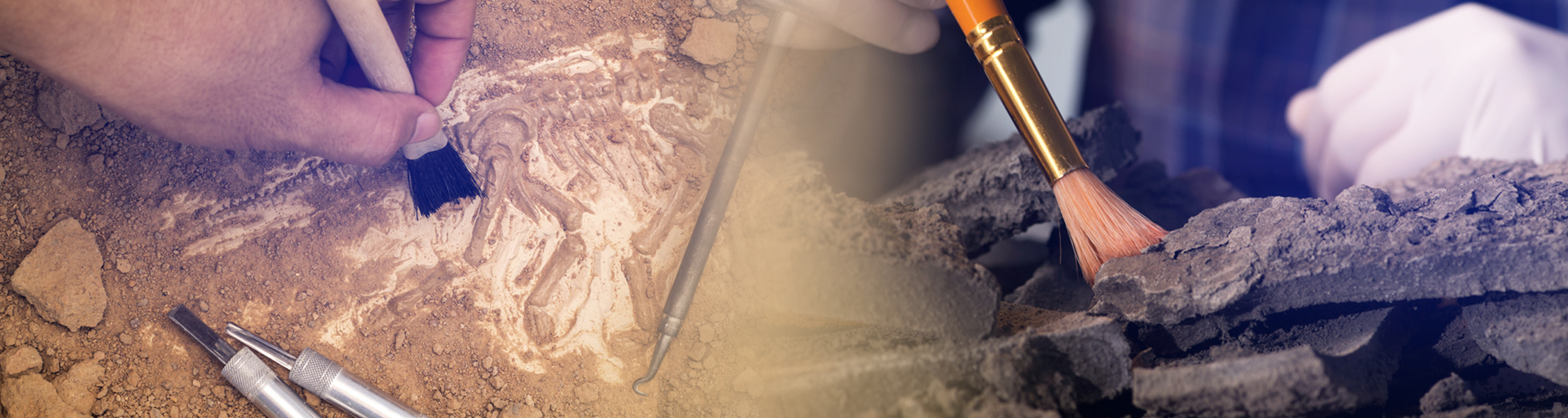
Sediment samples (between 10 and 20 gr) were processed according to standard palynological techniques. Three tablets of Lycopodium clavatum spores were added as markers prior to pollen extraction and in order to estimate representative pollen sums and pollen concentration. The standard procedures include: hot KOH 10 % to remove clays and humid acids, HCl 10 % to remove carbonates, heavy liquid with ZnCl2 (δ=2) to separate the mineral fraction by flotation, HF to remove silicates and acetolysis to eliminate organic matter [16,76,77]. The residues were mounted in glycerine and analyzed under microscope (1000 x) and pollen grains identification and preservation problems were performed by using the pollen reference collection of the Laboratory of Paleoecology and Palynology (UNMdP) (Figure. 1-Appendice).
Pollen diagrams were plotted using TILIAGRAPH (TGView, 2.0.2, Grimm, 2004). Palynological richness was calculated using the rarefaction technique in order to better understand vegetation dynamics and correlated with preservation indices. The analysis was performed with Psimpoll 4.10 [78] .
Differential preservation evaluation
In order to evaluate the different types of pollen deterioration and their possible associated causes (environmental factors, anthropogenic, sedimentological processes, among others) we determined pollen deterioration indices. Pollen damage characteristics considered are:
Biochemical damage: Corrosion causes the pollen exine to be pitted, etched or perforated and results from biochemical oxidation. Degradation causes general thinning of the exine and loss of structural elements, and results from chemical oxidation within aerial and subaerial environments. Ultimately the exine may deteriorate until only an outline of the grain is left.
Mechanical damage includes: Breaking or splitting grains, and crumpling grains, which can result from physical transport prior to deposition and/or from post- depositional sediment compaction.
In the present study we calculated four indices to recognize different types of pollen deterioration. Well preserved includes grains without observable deterioration. Biochemical deterioration includes degraded grains and this index was calculated as Total degraded pollen grains/ Total pollen grains. The Mechanical deterioration includes broken and crumpled grains. The index was calculated as Total (crumpled + broken) pollen grains/ Total pollen grains (Table 1). The pollen categories were determined by comparing the fossil pollen grains with perfectly preserved pollen reference collection from the Laboratory of Paleoecology and Palynology (UNMDP) (Figure 1- Appendice).
Table 1. Appendice: Biochemical and Mechanical deterioration index. The variation of values weretested with the Wilcoxon analysis. p-values were obtained for each sample, and all those that were minor than the 0.05 significance level, were significantly different from the data set. * indicates significantly well preserved and ** indicates significantly bad preserved.

Figure 1: Appendice: Examples of pollen reference collection of the Laboratory of Paleoecology and Palynology (UNMDP). a,b) Mulinum; c,d) Asteraceae subf. Asteroideae; e) Poaceae; f, g) Schinus; h, i) Nassauvia; j, k) Cariophyllaceae; l, m) Nothofagus; n,o) Berberis; p, q) Empetrum; r,s) Rubiaceae; t, u) Cyperaceae; v) Ephedra; w, x) Colliguaja; y) Euphorbia.

The values of the indices varied between 0 and 1. If all pollen had been well preserved, both indices would have been 0; the higher the indices, the poorer the preservation. The variation of values from the biochemical and mechanical deterioration index from the archaeological layer were tested with the Wilcoxon analysis. The p-values were obtained for each sample, and all those that were lower than the 0.05 significance level, were significantly different from the data set. Table 1-Appendice summarizes the indices calculated for all archaeological layers recorded.
Also, Spearman correlation analysis was carried out to evaluate the relationship between pollen concentration, palynological richness, biochemical deterioration index and mechanical deterioration index (Table 2). All these analyses were performed using the PAST 2.16 software [79]. The Figure 2 shows examples of preservation differences in pollen grains of all sites analyzed.
Table 2. Spearman’s correlation coefficient between pollen concentration, palynological richness, biochemical deterioration index and physical deterioration.

*moderate correlation
**strong correlation
***very strong correlation
Additionally, in order to identify possible causes of deterioration in our discussion of results we consider the following:
a. The pollen concentration of the samples analyzed, since it can be associated with cultural activities.
b. Presence /absence of tephra layers and / or bonfire in the archaeological layers analyzed.
c. Representativeness of anemophilous pollen types regarding to the geographical orientation of the cave (e.g. long distance types such as Nothofagus sp. and Podocarpus sp.)
d. Representation of exotic pollen types related to cultural activities in archaeological layers.
Electronic and optical microscopy
Additionally, photos in the electronic and optical microscopes were taken to exemplify differences in the grains preservation (Figure 2). For scanning electron microscopy (SEM) observations the sub-samples were dehydrated using ethanol 99%, mounted on exposed film, attached to studs, and coated with gold in Mar del Plata University (UNMDP).
Results
According to the calculated indices, although some layers of the archaeological sites analyzed presented some problems of preservation, the general results indicate that there was good pollen preservation. Total taxa, percentages of indeterminate, crumpled and broken pollen grains, concentration and pollen sum, and mechanical and biochemical indices calculated are shown in Figure 3. The results are described below.
Pueyrredón Lake area
Milodon Norte Cave (CMN1): In the samples of this cave good preservation is seen in both ornamental structures and walls of the pollen grains compared with the grains of the reference collection (Fig. 1-Appendice). The total pollen taxa oscillated between 5-24 and the percentage of indeterminate grains varied between 0-1 %. Only layer 6 of CMN1 was considered barren because the pollen count was of 20 grains. According to these results the mechanical and biochemical indices for this layer presents high and moderate values respectively (Figure 3. A, Table 1- Appendice). The pollen types with preservation problems (degraded, broken and crumpled grains) were Poaceae, Asteraceae subf. Asteroideae and Mulinum (Table 3).
Table 3. Summary of information of the archaeological layers with some type of deterioration (Biochemical and/or Mechanical), main affected pollen types and possible associated causes.

The pollen information for this cave showed an environmental scenario dominated by grass steppe associated with dwarf-shrubs and shrubs (high values of Poaceae, low values of dwarf- shrubs such as, Empetrum and Mulinum) during the early Holocene until the establishment of shrub steppe in the middle-late Holocene (distinctive pollen types are Mulinum, Berberis, Asteraceae subf. Asteroideae, Poaceae and Nothofagus) [71].
Milodon Norte Cave (CMN2): Remarkable preservation problems were found in CMN2 with very low pollen sum in layers 2, 3, 4, 5, 6 and 7 which were also considered barren due to low pollen sum and low pollen concentration. A low number of total taxa were found in this site. The degraded and crumpled grains varied between 10-40% and 5-40% in broken grains, with the highest percentages in the layers previously mentioned (Figure 3. B). The mechanical deterioration was statistically significant in layer 2, 3, 4 and 7 while the layer 5 was statistically significant in biochemical deterioration (Table 1-Appendice). The pollen types mainly affected in their preservation were Nothofagus, Poaceae, Mulinum, Asteraceae subf. Asteroideae and Euphorbiaceae (Table 3). Also, all grains observed under optical microscope in this site presented a very dark coloration.
This rock-shelter represents a temporary window of the last thousand years; the palynological information is scarce due to low pollen sum and bad preservation of grains. The main pollen types present are Mulinum, Asteraceae subf. Asteroideae and others shrubs, which can be associated to a shrub steppe [71]. Although pollen assemblages are consistent with CMN1 for the same period, CMN2 contains five archaeological layers in which important preservation problem have been found.
In this paper, summary pollen diagrams of CMN1 and CMN2 are presented, detailed information in the pollen results and their respective palaeoenvironmental reconstruction can be found in Horta et al. [34].
San Martín Lake area
Paisano Desconocido Cave (CPD): This cave presents some archaeological layers with degraded, crumpled and /or broken pollen grains. The total pollen taxa varied between 10 and19 and the indeterminate pollen ranged between 1 and 5%. Layers 1, 5, 6, and 7 presented high percentages of crumpled grains (5-80%) while percentages of degraded and broken grains were moderate (1-20%) and low (1-7%), respectively. This observation was made using the perfectly preserved pollen reference collection from Laboratory of Paleoecology and Palynology (UNMDP) as reference, see Figure 1-Appendice. The number of indeterminate grains was low because although many grains were crumpled, it was possible to distinguish their morphology. The pollen types mainly affected were Poaceae and Asteraceae subf. Asteroideae (Figure 2 and Table 3).
Also, the pollen sum varied between 100 and 292 grains, some of the lowest sums were found in layers with preservation problems. According with values of crumpled and broken grains, layers 1, 5, 6, 7 and 8 were statistically significant in the mechanical index (Table 1-Supplementary material). Very low values are present in biochemical index (Figure 3. C).
The cave CPD represents a temporary window between 8000 ± 40 14C yr BP and 3030 ± 30 14C yr BP. The pollen assemblage showed a grass steppe with high values of Poaceae and accompanying herbs in the early Holocene while in the middle Holocene a change is observed towards a shrub steppe (increase of Mulinum, Asteraceae subf. Asteroideae and others shrubs) [36].
Bloque 1 Oquedad (B1Oq): The rock-shelter B1Oq presents in general moderate pollen preservation. However, archaeological layers 1, 2, 6, 7, 10 and 15 showed some type of preservation problem statistically significant (Table 1-Appendice).
The number of total taxa varied between 5 and 13 and the pollen sum oscillated between 49 and 339 grains. Regarding these results, the lower pollen sums corresponds to archaeological layer 7 with preservation problem (45% degraded grains). The percentages of degraded and crumpled grains in layer 6 are 40% and 15% respectively. Moderate-low values of crumpled, degraded and broken grains are present in layers 1 and 2. Layers 1 and 2 showed mechanical deterioration (mechanical index: 0.32-0.28) while layers 6, 7 and 10 exhibited biochemical deterioration (biochemical index: 0.39-0.449- 0.26 respectively) (Figure 3. D and Table 1- Appendice). The total pollen taxa varied between 5 and13 and the indeterminate pollen range between 1% and 7%. The pollen types with preservation problems are Poaceae, Asteraceae subf. Asteraceae, Mulinum and Nothofagus (Table 3).
For 2270 ± 50 14C yr BP the pollen assemblage of B1Oq showed a vegetation dominated by Asteraceae subf. Asteroideae that changed to a vegetation represented by grass, herbs, Asteraceae subf. Asteroideae and Mulinum mainly [36] (Figure 3).
Discussion
Taphonomic processes and pollen preservation and concentration: sedimentation, erosion, exposition to fire, anemophilous pollen dispersal and antropogenic influence
Pueyrredón Lake area: Milodon Norte 1 Cave (CMN1): relation with erosion and anemophilous pollen dispersal In cave CMN1, samples conservation was good in all layers except in layer 6 (Figure 3).
The main cause of deterioration in this layer was due to mechanical damage (statistical significance 0.70- Table 1-Appendice). In addition, a low pollen concentration was observed and the main deteriorated pollen types were Poaceae, Asteraceae subf. Asteroideae and Mulinum. López Sáez et al. [29] suggest that one of the main agents that destroys pollen grains is mechanical degradation. During the transport and sedimentation phases, some pollen grains are more easily deteriorated than others. The pollen type Poaceae presented broken grains, which can be associated with the thin pollen wall more vulnerable to breakage due to the abrasion that could be exerted by loose particles such as sand in sediment deposition (pollen-clasts collisions). Asteraceae subf. Asteroideae and Mulinum presented degraded and crumpled but not broken grains. This may be due to the fact that the walls of these grains are relatively thick which prevents breakage by abrasion when compared to the characteristics of Poaceae. In the case of degraded grains (biochemical index: 0.10) it can be explained by the moderate presence of fungi in the sediments, which, although they did not exert a marked deterioration in the walls, damaged the ornamental structures. In these grains, the sculptural and structural details were determined with difficulty during the observation of the microscope. In relation to sedimentology, layer 6 is composed of sandy and carbonaceous sediments, which may be related to the poor amount and preservation of pollen grains present. According to Havinga [80] chemical compounds of a basic nature, such as carbonate, can act as degradation agents of the pollen wall. Another point considered in this cave was the presence of anemophilous pollen types, mainly Nothofagus as a transport pathway. In CMN1, Nothofagus presented high concentration possibly associated with an overrepresentation of the taxon. The orientation and height of the cave entrap the pollen grains carried by the winds from the west.
Milodon Norte 2 Cave (CMN2): an example of exposition to fire and antropogenic influence The archaeological layers of CMN2, presented an abundant amount of charcoal particles, which is an indicator of the presence of bonfires associated with cultural practises by hunter- gatherer groups. According to the archaeological data, this sequence has successive levels of bonfires, charcoal particles and the presence of bone fragments burned, mainly present in archaeological layers 2, 3, 4, 5 and 7. The high temperatures to which the pollen grains were exposed may be the main cause of conservation problems. In these grains, the structural elements seem to be partially fused, as if the exine were molded by some soft substance that had come together under the influence of pressure or heat. The high temperatures related to fire, such as the bonfire, are an extreme case of oxidation, which damages the wall quickly when oxygen is available.
In all the layers with pollen preservation problems it was observed that Nothofagus, Poaceae, Asteraceae subf. Asteroideae, Mulinum and Euphorbiaceae were the most affected pollen types. Havinga [13] has shown that the sporopollenin content of pollen grains is variable, and as sporopollenin is apparently the most oxidation-resistant component of the pollen grain, its abundance in the exine strongly affects the susceptibility of the grain to oxidative destruction. Poaceae and Nothofagus present walls with characteristics psilate and microechinate that may be more likely to be damaged and / or broken by mechanical factors such as the above mentioned.
These grains have a very thin exine that can disappear from the sediments by breaking up into pieces too small to be recovered or identified. In this cave the damage is mainly generated by broken or crumpled grains. Moreover, layer 2 presents an ash level that can alter the thermal properties and permeability of soils causing damage to the walls of the grains [10].
Also, this layers present moderate biochemical deterioration (Figure 3. B and Table 1- Appendice) that also affects the pollen preservation. Regarding the Spearman correlation coefficient, there is a strong correlation between mechanical deterioration produced by charcoal and the pollen concentration and between palynological richness and mechanical deterioration (Table 2). These results indicate that in CMN2 the lowest values of pollen concentration are associated with layers which have the highest index of mechanical deterioration (Table 2). The high charcoal proportion is an indication that the high temperatures of the bonfire not only affected the walls of the grains but also, in some cases, caused the total destruction of the grains. Furthermore, these layers showed grains with dark colors (Figure 2. j) and very low pollen sum (Figure 3. B). According with Campbell [10] the thermal alteration is principally observable as a progressive darkening of the grain, from yellow through orange-brown to red-brown, brown, and black. In CMN2, this depends on the site of the cave where was the bonfire and heat range in sediments. In addition, the few pollen types preserved were those with more robust exine.
Figure 2: Examples of pollen grains showing different types of deterioration. Electronic microscopy: a) Partly degraded Asteraceae subf. Asteroideae; b, c) Partly degraded Asteraceae subf. Asteroideae (detail of spine); d- f) Partly degraded Nothofagus; g, h) Partly degraded Cariophyllaceae; i) Charcoal detail. Optic microscopy (all pollen grains photographed at x1000 magnification): j) Exine very dark of Nothofagus; k, l) Partly broken grains of Nothofagus; m) Partly degraded Cariophyllaceae; n, o) Partly degraded Asteraceae subf. Asteroideae.

On the other hand, pollen types such as Euphorbiaceae and Mutisieae are present at high percentages in this cave [34]. The pollination type of these taxa is entomophilous, so an underrepresentation is normally expected. The high values found may be due to the fact that these ornamental flowers could have been brought to caves by hunter-gatherer groups [34]. However, it is important to notice that the pollen representation variation could be related not only to bias in the preservation but also to differences in the anthropogenic use of archaeological sites.
San Martín Lake Area: Paisano Desconocido Cave (CPD) and Bloque 1 Oquedad (B1Oq): sedimentation, erosion and oxidation
The values of biochemical and mechanical deterioration index of CPD suggest that mechanical damage prevails in this site compared to the biochemical one (Figure 3. C, Table 1 - Appendice). The archaeofaunal records indicate the predominance of Lama guanicoe with signs of anthropogenic processing. In this sense, the archaeological record (manufactured artifacts and debitage) indicates the logistic use of this space, but temporarily. This site may have functioned as operational camps, where humans, hunter gatherers inhabitants could have articulated logistic items (catching prey and obtaining rocks and / or pigments) [68]. Therefore, the development of these activities does not seem to be the main factor that could have affected the physical preservation of the grains. The CPD site mainly presents colluvial-eolian laminated sediments with sandy-clayey lenses [68]. The accumulation of material of different size but homogeneous lithology included in a sandy-clayey matrix could have been transported by gravity and be one of the causes of the crumpled pollen grains by sediment transport. According to Súnico (personal communication) in the upper part of the cave, there is a process of erosion and moisture in the rock, mainly evident in the contact areas between the rock and the cave floor together with the strong accumulation of salts, which results in the slabs on the floor of the cave being released from the ceiling and pH changes in sediments. The presence of saline sediments may be related to crumpled pollen grains, mainly in 5, 6 and 7 layers. In Campbell [10], a tendency to rupture in distiller water and a to pucker inwards in stronger salinities in pollen grains were showed. Causes such as pH change in sediments, wet-dry cycles, may have favored the biochemical deterioration of pollen grains by oxidation. Campbell [10] and Havinga [13] have shown that the pollen is perhaps oxidized more readily than it is damaged by most other means. Oxidation is likely mediated in part by pH, particularly in soil. The microbial attack proceeds more readily on a pollen grain that has firts been somewhat oxidized, if only by prolonged exposure to air. In addition, the effect of repeated wet-dry cycles was shown to control the mechanical destruction of pollen grains since, it causes flexion with repeated shrinking and swelling [17,18]. In this study, according to the Spearman rank correlation coefficient (Table 2), biochemical deterioration has affected the pollen concentration to a moderate degree (-0.59). Given the calculation of the mechanical and biochemical deterioration indices for B1Oq, layer 6 seems to divide the sequence into two general deterioration patterns. In the upper part the mechanical deterioration prevails over the biochemical and in the lower part the opposite pattern is observed. The B1Oq site is composed of relatively homogeneous aeolian sediment without clear evidence of variation in composition and consolidation [69,70]. The abrasion between the sediments could have had an influence on the mechanical deterioration of the pollen grains (Figure 3. D, Table 3 and Table 1-Appendice). Although, there is a strong anthropogenic influence on the site for the late Holocene (guanaco bones with anthropogenic modifications and other archaeological signal). The intense use of the site and the increase in human activities in c.a. 1000 yr BP does not seem to be a determining factor in the mechanical damage found in pollen grains. Towards the end of the deposit (upper block) post-depositation processes are observed possibly by the action of the rodents; nevertheless this does not seem to be the determinant factor of the mechanical deterioration of the grains of pollen. There is a strong correlation between the rate of biochemical degradation and the palynological richness (Table 2). In this case, oxidation could also be the main cause of the biochemical deterioration found. However, there is no direct evidence of a factor that could be causing this biochemical deterioration.
Figure 3: Diagram with percentage of poorly preserved grains, sums and pollen concentration and biochemical and mechanical indices of the archaeological sites studied: A- CMN1, B- CMN2, C- CPD and D- B1Oq.

In many environments of Patagonia there are not continuous records, so archaeological sites are an important deposit for palaeoenvironmental reconstructions [26,32,34,36]. However, it should be considered that the information provided represents temporal windows and may present some anthropogenic bias, so it is important to study the potentiality of the sequences through preservation analysis. On the other hand, it is important to compare the information provided by archaeological sequences with the palaeoenvironmental information provided by continuous sequences. In this sense, the archaeological sites considered in this paper (CMN1, CMN2, CPD and B1Oq) were compared with continuous sequences (LF and LT) published in Bamonte y Mancini [81]; Bamonte et al. [36]; Marcos et al. [82]. This comparison allowed the detection of biases in the pollen information of archaeological sites and complemented palaeoenvironmental interpretations. In this paper summary a schematic model of vegetation changes from the archaeological sites (CMN1, CMN2, CPD B1Oq) and nonarchaeological sites (LF and LT) are presented; the details of the paleoenvironmental reconstructions of sites were published in Marcos et al. [71], Marcos et al. [82], Bamonte et al. [34, 84] (Fiure 4).
Conclusion
According to the biochemical and mechanical indices, the samples of archaeological sites analyzed in this paper present a good and/or moderate preservation. In this sense, we concluded that this archaeological caves and rock-shelter (CMN1, B1Oq and CPD) studied in this paper present relevant information to perform palaeoenvironmental reconstructions. However, the preservation problem and low pollen sum present in CMN2 indicated that it is not rigorous enough to carry out apalaeoenvironmental reconstruction. The low pollen sums present in CMN2 are mainly due to the high temperatures (bonfire) at which the pollen grains were exposed and that completely destroyed them.
In the archaeological sites CMN1, B1Oq and CPD, there was evidence of preservation problems (biochemical and mechanical deterioration), but these were not significant. The main factors that affected pollen preservation were exposure to high temperatures, abrasion of the sediments, oxidation, pH effect that caused mechanical damage and the presence of fungi associated with biochemical damage.
In addition, we consider in this paper other complementary items in pollen analysis (contribution of anemophilous and exotic pollen types, antropogenic factors and post-deposition processes). The influence of the westerly winds and their consequent contribution of long-distance pollen overrepresented the Nothofagus signal in CMN1. In CMN2, the high values found of Mutisieae and Euphorbiaceae may be due to the fact that these ornamental flowers could have been brought to caves by humans. Antropogenic and post deposition factors had no significant influence on pollen deterioration. The analysis of these factors complements the pollen information obtained from each archaeological layer, as well as it allows to comprehension of other causes that have affected the preservation of the pollen.
The most samples of archaeological site analyzed in this paper present a good preservation condition. The general results show that the problems of pollen preservation of CMN1, CPD and B1Oq were low and / or moderate. In this sense, these sequences provide important information to perform palaeoenvironmental reconstructions.
At last, taking into account that archaeological sites in general represent temporary windows of palaeoenvironmental information, the interpretation of the information as a whole of the archaeological and non-archaeological sites allows to complement the palaeoenvironmental history available for the study areas.
Acknowledgements
This research was financially supported by CONICET (PIP 1265) , UNMdP (EXA 602/12, EXA 738/15) and PICT 1722/15. We thank Carlos A. Aschero, Teresa Civalero, Luis Horta, Juan Bautista Belardi, Silvana Espinosa for providing archaeological samples and Alejandro Súnico for his personal comments.
Analytical and Applied study of the Influences of Astronomical Phenomena on Islamic Architecture
There are many Islamic architectural models that have been closely associated with astronomical phenomena, and here will address the most important architectural models as follows;
The primary Mosques in Islamic times and the process of directing towards the Qiblah
The first mosques were established in Islamic times depending on some cosmic and astronomical phenomena such as the sun, moon, stars and winds, which were the most practical methods to find thedirection of the Qiblah. These astronomical phenomena were also used to determine and adjust the calendar, whether it be solar, lunar, astral, agricultural and religious, as well as these phenomena used in reckoning the times of day and night-time, this was by the length of the shadow, in addition to the locations, phases and passes of the moon and the sun, where from fourteen centuries ago, there were many verses in the Qur’an that describe how Allah created the cosmic and astronomical phenomena. For example, but not limited in the verse five of Surah Yunus from the Qura’n, Allah Almighty said” He is who made the sun a shining light and the moon a derived light and determined for it phases that you may know the number of years and account [of time]”[258-260](k). It is worth mentioning that the Qiblah has been adjusted and determined according to the astronomical horizon of the required phenomenon such as the rise or down of a notable star, as well as the locations of the sun at the equal point of night and day or the so-called equinoxes, in which the center of the seen sun is directly above the equator, in addition to the summer and winter solstices or the socalled solstices, in which either of the two times, known as summer solstice and the winter solstice of the year, this when the sun reaches its highest or lowest point in the sky at noon, marked by the longest and shortest days [261-265]. For example, it is known that the stars are raised and dropped at specific ranges on the horizon for a certain location, where at the time of the equinoxes, the rise and set of the sun determine the east and west, and the locations of the sunrise and sunset at the solstices will be about 30 degrees in a northward position or direction in middle of the summer, and about 30 degrees in a southward position or direction in middle of the winter.In North West Africa, the Qiblah will be towards the sunrise at the time of the equinoxes; in Egypt, the Qiblah will be towards the sunrise at the time of the middle of the winter; in Syria, the Qiblah will be towards the rise of the star known as Canopus; in Iraq, the Qiblah will be towards the sunset at the time of the middle of the winter; in India, the Qiblah will be towards the sunset at the time of the equinoxes; in Yemen, the Qiblah will be in the direction of the northern wind blowing, which will be towards the polar star that does not rise nor fall, however its location in the north [138, 266-268] (Figures 4-5).
Figure 4: A diagram illustrates how astronomical directions were determined by Ibn Khordadbeh, the 9th century .

Figure 5: A diagram explains the cardinal winds, including the Qabūl wind or the so-called Sabā, as well as the dabûr wind and the astronomical objects such as Canopus that is from the most brightest star in the sky and in the southern hemisphere, as well as the process of Canopus rising in a vertical way to the axis through the sunrise in the summer and sunset in the winter in accordance to the latitude of Mecca (After: King, D., (2018). Finding the qibla by the sun and stars, a survey of the sources of Islamic sacred geography, Johann Wolfgang Goethe University, Frankfurt, p.8).

mosques, as well as the design of Islamic structures and cities, which were associated with the detection and control in the direction of the Qiblah. It is worth mentioning that some of the first mosques were directed towards the sunrise in winter time, this is due to the belief that makes the walls of the Qiblah are paralleled into the northwest wall of the Kaa’ba, and this applies to some of the oldest mosques established in Egypt like the mosque of Amr ibn al-’as in Fustat. However, the major mosque should face the vertical direction of sunrise in summer time, where the same direction was identical to the northwestern wall of the Kaa’ba [158, 269]. The direction of qiblah and the orientation of the first mosque built in Al Fustat, Cairo- Egypt, which oriented to the sunrise in the winter season, where this mosque was constructed in the winter season of the year 641-642, so the qiblah was in the direction of sunrise in the winter at about 27 degrees southeast [169] (Figures 4-5).
The Kaa’ba and its relation to astronomical phenomena
The Kaaba, the most sacred place in Islam, is located in Makkah in western Saudi Arabia, which means a cube in Arabic; it is a square stone building, draped in a veil of silk and cotton, where Muslims must face during prayer times. Noteworthy that the axis of the Kaa’ba is oriented towards the real north, with a deviation of about 7 degrees to the east, the process of directing the Kaa’ba in this technique made it related to some astronomical phenomena, where the sun rises in the summer in front of the northern wall, which by the eastern door of the Kaa’ba, and in winter, the sun goes down in front of the north-west wall, between the Yamani and Shami corners, moreover the perpendicular direction to the rib between the corner of the Black Stone and the Yamani corner takes the direction of sunrise in winter, and at the same time, it takes the direction of the star Suhail, or the so-called Suhail of Yemen at sunrise to the south east. The rib between the Iraqi corner and the Shami corner takes the direction of three stars in the hands of the plough in the Big Dipper group, which called Banat Na’sh by the Arabs, consisting of seven bright stars of the constellation Ursa Major [143,270-271]. It is clear that the influences of astronomical phenomena including constellations and stars such as Canopus, known as Suhayl, along with the azimuth of sunrise and sunset, and the azimuth for the star Canopus were affected on the Kaa’ba and on the sacred geography of Makkah (Figures 6-7).
Figure 6: Astronomical orientations and alignments of the Kaa’ba, including sacred geography and topography of Makkah and related methods of directing towards the Kaa’ba according to the azimuth of sunrise and sunset, and the azimuth for the star Canopus.

Figure 7: A design of the Kaa’ba and the alignments of its axes with the four directions of the cardinal winds, and this were described in the Arabic and Islamic sources, dating back to the 7thcentury.

After 623 AD/Second year AH, the direction of these prayers was towards the Kaaba of Makkah instead of Jerusalem; this is right direction and sacred direction to pray, known as the Qiblah [152,272-279]. The Qiblah was determined by Muslim astronomers through the direction of the major circle that link the locality to Makkah, which has been measured by the angle of the regional meridian that is known as a circle of constant longitude that pass through a given location on the earth’s surface and the terrestrial poles [266,275,278] (Figure 8).
Figure 8: The mathematical issue of finding and determining the Makkah direction of (M) from a grade (X) that involve detecting the angle that the great-circle arch (XM) produce with (PXA) the so-called meridian at the point of(X), where it is needed to be known the latitudes or the angular distance of a place north or south of the earth’s equator, or of a celestial object north or south of the celestial equator, commonly expressed in degrees and minutes, where the latitudes of (X) and (M) will be measured by(XA) which equals (a),and also (MB) that equals (b), as well as (AB) which is an arch of the equator, then the longitude difference will be measured by (AB) which equals(c).

Since the eighth century onwards, there were a large number of Islamic astronomical manuscripts [280] that include tables, known as Zijes, including measurable factors used for astronomical and mathematical determination of the locations of the sun, moon, stars, constellations and planets, as well as the procedures for determining the Qiblah [22,281-282] (Figures 9-10).
From the above mentioned, there are some factors linked to the influences of astronomical phenomena on Islamic religious architecture in general, and the architecture of mosques in particular, including sacred geography and topography of Makkah and related methods of directing towards the Kaa’ba, constellations and stars such as Canopus, known as Suhayl which is the brightest star in the southern sky of Makkah, along with the summer and winter sunrise or sunset, summer and winter solstices, the cardinal directions and monsoon, and the orientation of mosques towards the qiblah and mihrab (Figures 4-11).
Figure 9: A geometrical diagram for detecting the Qiblah direction, including cardinal directions that are in the circle horizon, then parallel line to the east and west, where the separated line will be the latitude which measured by the circle, in addition to the drawn line between the middle point or centre of the circle and the grade of intersection, known as the crossing point, where the intersection between the last two lines will be direction of the Qiblah.

Figure 10: An illustration extract from astronomical manuscript of Ibn al-Sarraj al-Dimashqi, dating back to the 14th century, which reveals the direction of the Qiblah.

Figure 11: A diagram notifies the directions of the Kaa’ba and orientations of the qiblah according to different sites such as Cairo, Jerusalem and Damascus.

Applied study on selected models of Islamic religious architecture in Cairo
The Mosque of Amr ibn al-As in Al Fustat, which was built in 641–642 AD [283-284], the directions of the qiblah adjusted according to the channel that linking the Nile to the Red Sea, this channel was in the north of Al Fustat that was built by the ancient Egyptians and reconstructed or restored by the Muslims, so there were orthogonal streets close to the side of the channel, which was flowed in a vertical direction to the qiblah of the Mosque of Amr ibn al-As in Al Fustat. Therefore, the whole city of Al Fustat was designed around 27 degrees southeast of the qiblah. It is reported that the Fatimid astronomer known as Ibn Yunus regulated the qiblah of the Mosque of Amr ibn al-As in Al Fustat by mathematical procedures as about 37 degrees southeast [266, 285](Figure 12).
The historian and geographer called Al-Bakri [286-287](l) mentioned that when the Fatimid Caliph Al-Mu’izz [288](m) wanted to convert or change the qiblah of the mosque of Amr, almost in 956- 957 AD, there was a great objection due to redirect errors that can occur [169, 289] (Figures 6-13). It is worth mentioning that there were several directions for the qiblah that used in the mosques of Cairo-Egypt, and when the historian called Al-Maqrizi [290](n) discussed the deviations of the mihrabs[291-292](o) in Islamic mosques in Egypt, he identified at least four different orientations for the mihrabs[169, 289](Figure 13).
Figure 12: A scene of the Old Islamic Cairo, where the channel is illustrated.

Figure 13: The different orientations for the qiblahs that was used in Islamic mosques of Egypt according to Al-Maqrizi.

In the previous diagram (Figure 13) and as Al-Mqrizi mentioned that the first direction of the qiblah was in the mosque of Amr in Al Fustat, this was according to the sunrise in winter season at about 117 degrees, which known as the qiblah of Al sahabah or the companions of the Prophet [293](p), while the second direction of the qiblah and orientation of the mihrab was in the mosque of Ibn Tulun[283](q) at about 141 degrees south of the qiblah of astronomers that was calculated mathematically; the third qiblah direction was in the mosque of Al Azhar that was also adjusted and calculated mathematically, and the fourth qiblah direction and orientation of the mihrab was in the city of the dead, or the so-called Al-Qarafa of Cairo [294-295](r), the main layout axis of Al-Qarafa and most of the surrounding mosques were oriented in a southwards, this is due to the astronomical phenomena accounts of the Qiblah direction, where the internal and external layouts of Al- Qarafa and its architectural components were roughly arranged and aligned with the astronomical direction of the Qiblah [138,169,266]. The first mosques of the Fatimid religious architecture in Cairo, such as the Mosque of Al-Hakim bi-Amr Allah [296-299] (s) and the Mosque of Al-Azhar [300-301] (t) were constructed at about 10 degrees inclined to the street design in order to agree with the direction of the qiblah [266]. It was noted that some Mamlūk religious architecture in Cairo are arranged in a straight line with the outside design of the Fatimid city and the internal qiblah direction of the Fatimid mosques, which was in 117 degree according to winter sunrise, and during the 10th century upwards the direction of qiblah was in 127 degree. In some districts of Cairo, the direction of the qiblah was adjusted according to the rising and setting of the star called Canopus; this was between 156 and 204 degrees [138, 266,302]. So there are some adjustments that have occured in the direction of the qiblah and there were different directions for the qiblah and various orientations for mosques (Figure 14).
Figure 14: A diagram illustrates the changes and adjustments of the orientations of qiblah and mosques in Cairo by mathematical procedures.

From the above mentioned, it is clear that the astronomical phenomena affected the construction of the Fatimid mosques in Cairo [303-304](u), including the mosque of Al-Hakim bi-Amr Allah [296-299](s), as well as Al-Azhar mosque [300-301](t), which were built at a deviation of 10 degrees to the main planning of the street, this was according to the astronomical calculations of the Qiblah direction. Furthermore, it was observed that the prayer area of al-Azhar mosque was crossed by a passage at right angles to the Qibla direction; this is similar to the Fatimid architectural design of the great mosque of Mahdiya in Tunisia [9, 305-306](v). As for the Mamluk religious architecture in Cairo [10, 307-308](w), the exterior layout of the main street was arrange and aligned with the astronomical phenomena calculations of the Qiblah direction. Regarding to the city of the dead or the so-called Al-Qarafa of Cairo [294-295](r), it is observed that the main layout axis of Al- Qarafa and most of the surrounding mosques were oriented in a southwards, this is due to the astronomical phenomena accounts of the Qiblah direction, where the internal and external layouts of Al-Qarafa and its architectural components were roughly arranged and aligned with the astronomical direction of the Qiblah[138, 169, 266]. In accordance with the Egyptian historian Al-Maqrizi and the fifteenth century sources [138, 266], there are different directions for the qiblah in Cairo-Egypt as shown in the following diagram (Figure 15).
Figure 15: A diagram clarifies the qiblah directions and the mosques orientations in Cairo according to astronomical sources, where there were different directions and various deviations.

In the previous diagram (Figure 15), it is clear that in (a) of the diagram, the qiblah directions adjusted according to the east, in (b) of the diagram, the direction detected due to winter sunrise, in (c), the direction regulated by the astronomer Ibn Yunus, and from (e) to (g), the direction adjusted according to the rising and setting of Canopus / Suhayl [138, 266] (Figures 5-7, 13). It is worth mentioning that in some Mamluk religious architecture bordering the main road of the Fatimid city, like the madrassa and mausoleum of Al-Nasir Muhammad [309-310](x) dating back to the early fourteenth century (Figure 16).
Figure 16: A design for Al-Nasir Muhammad madrassa.

previous design (Figure 16), it is clear that the external wall of the madrasa was aligned or arranged according to the main street planning, and was vertical to the qiblah of Al sahabah in a straight line at an angle of 90 degrees, while the facade of the madrassa was not aligned to the street planning, but rather to the axis of the city, and the external and the inner of the facade wall were inclined to each other at about 10 degrees, and this was the deviation and variation between the two qiblas of Al sahabah and astronomers [138,169,266], where it is observed that the facade of this madrassa and mausoleum was aligned or arranged in a straight line according to the street, however the inner part of this building was inclined to the orientation of the qiblah that was astronomically adjusted, and this was in order to align or arrang the the external parts of this buildings with the true qiblah of Al sahabah [138,169,266] (Figure 17).
The previous diagram (Figure 17), it is clear that the Fatimid city (A), which was aligned with the qiblah of Al sahabah, while the Mamluk religious architecture(B) was aligned with the qiblah of the astronomers that mathematically determined, and the city of the dead or the area of Al-Qarafa (C) was aligned towards the south [138,169,266] (Figures 4-7, 11-13). From the above mentioned, it is clear that there were differences and deviations in the directing procedures throughout the ages of Islamic religious architecture, and this is due to the influences of astronomical phenomena on Islamic architecture in general, and on Islamic religious architecture of Cairo in particular.
Figure 17: A diagram illustrates orientations of the qiblah in three main areas.

Conclusion and Analysis of the Study
Islamic architecture and Heritage structures included numbers of scientific applied manifestations and astronomical phenomena. One of these architectural manifestations is the astronomical phenomena that have not been discussed deeply and have not been concentrated and strongly investigated by researchers. This study seeks to discuss the extent of effect of astronomical phenomena on Islamic architecture that include a vast layout of architectural styles and structural designs which were varied from one structure to other building through the different Islamic ages. The main Islamic architectural models include religious, funeral, civil, urban and military architectures such as Mosques, Mausoleums, Khanqahs, Zawiyas, Madrassas, Palaces, Turrets or Towers, Castles and Fortresses, in addition to domestic architecture that includes the public baths or the socalled Hammams, Fountains, Sabils and Kuttabs. For all these architectural models and structural designs of buildings, the Islamic and Heritage styles of architecture created and developed precious astronomical techniques, which were necessary to construct these architectures. But due to the wide content of the idea of this study, the topic will be limited on the influences of astronomical phenomena on Islamic architecture, analytical and applied study on selected religious architectural models in Cairo. There are many questions arose when studying the influences of astronomical phenomena on Islamic architecture and Heritage structures, the answers to these questions proved that the astronomy is one of the oldest and important natural sciences, and it also has significant contributions to Islamic civilization. The Muslim astronomers have many contributions, where they were aware of astronomical phenomena and studied the astronomical models of stars and planets in the Ptolemaic period, also improved the techniques of mathematical calculation and computation ways, in addition to develop the methods of observation, as well as creating precious observational tools, they also founded extensive observatories, in addition to improvement of planetary models in order to observe, monitor and control movement and shifts of constellations, stars and planets in accordance with the evolution of cosmology. The contributions of Muslim astronomers arrived its highest point during the so-called Islamic Golden Age (during the 8th -13th centuries), where the Islamic world was seen as a scientific center of innovations and discoveries. The contributions of Muslim astronomers were extended over a wide area of the Arab lands, where the names of these Muslim scientists became known for their valuable astronomical observations and scientific calculations, which were the main cause for the emergence of the light of astronomy during the modern times. There are prominent Muslim astronomers, who are the pioneers of astronomy throughout Islamic times, where there are many important astronomers, but to mention not exclusively, for example Al-Khwarizmi (ca. 780-850), Al-Battani (ca. 858 – 929), Al-Sufi (ca. 903– 986), Ibn Yunus (ca.950- 1009), Al-Biruni (ca. 973– 1050), and Omar al- Khayyam (ca.1048- 1131). During the 8th-15th centuries, there were some benefits of astronomy and astronomers, which were carried through precious observations and exact monitoring of cosmic phenomena and celestial objects, resulting in valuable astronomical tables that benefit Islamic architecture. Later, the Islamic astronomy has a great impact on other astronomical features that prevailed in other countries across the world such as the astronomy of Byzantine Empire, Indian astronomy, Chinese and European astronomy, where there are a great number of names of stars and constellations are still known by their Arabic names. From the 8th-15th centuries, there were nearly ten thousands manuscripts related to Islamic astronomical phenomena and approximately more than a thousand tools linked to astronomical phenomena during the Islamic ages, which are kept in museums and libraries of Near, Middle and Far East, as well as in different counties around the world. The most important features of Islamic astronomy and what related to astronomical phenomena are the models of astronomical tools and how to apply astronomical techniques in different fields of religious beliefs and rituals during the different Islamic ages. Moreover, the Islamic calendar, or the so-called Islamic lunar calendar that depends on the phases of the moon, and from an astronomical point of view, it relates to the times of prayer, as well as the direction of Qiblah, where it must be oriented towards the direction of the Sacred Mosque of Kaa’ba at Mecca, in addition to the only important architectural requirement in any mosque is to correctly directed towards the Qiblah of Kaa’ba. The locating, monitoring, directing and determining for the true direction of the Qiblah was an important matter and critical issue of the Islamic architectural scientific studies and for Muslim astronomers throughout the Islamic ages. There are some links and requirements associated with the manifestations of Islamic astronomy, which can be addressed through the astronomical phenomena that require survey and surveyor, geography and geographer, mathematics and mathematician, in addition to scientific observations of astronomical phenomena related to astronomy and astronomer, as well as astrology and astrologer. Furthermore, there are scientific studies conducted by Muslim astronomers throughout the Islamic ages and related to orientation schedules of the Qiblah. The mosques and madrasas in Cairo, which were from early Mamluk age upwards used astronomical tables related with astronomical phenomena, this was in order to determine time by the sun and to regulate the five daily prayers times, which linked to the science of timing or the so-called muwaqit. Some of these astronomical tables were collected by the Fatimid astronomer called Ibn Yunus, and other astronomical tables were gathered by different Mamluk astronomers. One of these tables regulates the altitude or the rise of the sun in points or degrees and minutes that agree almost exactly to each day of the solar year. There are many astronomical influences that are closely linked to Islamic architecture, which was resulted from the idea and through the process of linking the architectural structures of the earth with the celestial objects. The influences are emerged through the ideas and concepts of linking between the designs of architecture and some astronomical phenomena that are related to the apparent movement of the sun and the moon in particular, or some other constellations and planets that could not be seen with the naked eye. The astronomical phenomena were used by Muslim astronomers in monitoring and directing the Qiblah of mosques to Mecca, as well as these astronomical phenomena were influential factors in determining prayer times, for this purpose, the astronomers used an effective method called sundials, which were particularly used in determining prayer times of Dhuhr (midday) and ‘Asr (afternoon). In Islamic religious architecture of Cairo, the sundials were used effectively, for example but not limited to the marble sundial of Al-Azhar mosque, and the sundial of mosque of Muhammad Bey Abu al- Dhahab. The seventh century AH is one of the most important historical periods in the construction of Islamic observatories, where the construction of an observatory was built at this time in the city of Tabriz, known as the Maragha observatory that was one of the historical capitals of Iran, which was managed by many Muslim astronomers such as Nasir al-Din al-Tusi (ca. 1201-1274). Islamic architecture was influenced by astronomical objects, celestial bodies and cosmic phenomena, which lie in the knowledge of Muslim astronomers and architects of importance and significance of cosmic phenomena, celestial objects, astronomical manifestations that influenced the architectural characteristics of Islamic architecture, in addition to how to benefit from these phenomena in the processes of architectural construction, as well as how to take advantage of these phenomena and manifestations in structural and geometrical building designs. Examples of these astronomical phenomena lie in the use of astronomical phenomena to determine the exact and correct direction of the Qiblah, also the use of sundials and astrolabes in mosques to adjust prayer times, as well as tracking and monitoring the movement of celestial objects in their cosmic cycles and astronomical phases , in addition to observing, tracking and monitoring the motion of the sun, as well as the orbits and phases of the moon , this in order to be used in the process of timekeeping and to be benefited from them in adjusting prayer times , where there is a need for determining and adjusting the time of certain acts of worship in Islamic beliefs, such as prayer times associated with the movement of the sun, as well as the length of shadows that were differentiated. It is worth mentioning that some acts of worship in Islamic beliefs such as fasting or Sawm, Hajj, and Zakat or Zakah that were associated with monitoring the crescent, or the so-called crescent observation and also linked to determining the beginnings and ends of Arab months. There are many Islamic architectural models that have been closely associated with astronomical phenomena, for example but not limited to the first mosques were established in Islamic times depending on some cosmic and astronomical phenomena such as the sun, moon, stars and winds, which were the most practical methods to find thedirection of the Qiblah. These astronomical phenomena were also used to determine and adjust the calendar, whether it be solar, lunar, astral, agricultural and religious, as well as these phenomena used in reckoning the times of day and night-time, this was by the length of the shadow, in addition to the locations, phases and passes of the moon and the sun, where from fourteen centuries ago, there were many verses in the Qur’an that describe how Allah created the cosmic and astronomical phenomena. It is known that the stars are raised and dropped at specific ranges on the horizon for a certain location, where at the time of the equinoxes, the rise and set of the sun determine the east and west, and the locations of the sunrise and sunset at the solstices will be about 30 degrees in a northward position or direction in middle of the summer, and about 30 degrees in a southward position or direction in middle of the winter. In North West Africa, the Qiblah will be towards the sunrise at the time of the equinoxes; in Egypt, the Qiblah will be towards the sunrise at the time of the middle of the winter; in Syria, the Qiblah will be towards the rise of the star known as Canopus; in Iraq, the Qiblah will be towards the sunset at the time of the middle of the winter; in India, the Qiblah will be towards the sunset at the time of the equinoxes; in Yemen, the Qiblah will be in the direction in which the northern wind blowing, which will be towards the polar star that does not rise nor fall, however its location in the north. From the above, it is clear that the astronomical phenomena have affected the architecture of mosques, as well as the design of Islamic structures and cities, which were associated with the detection and control in the direction of the Qiblah. It is worth mentioning that some of the first mosques were directed towards the sunrise in winter time, this is due to the belief that makes the walls of the Qiblah are paralleled into the northwest wall of the Kaa’ba, and this applies to some of the oldest mosques established in Egypt like the mosque of Amr ibn al-’as in Fustat. However, the major mosque should face the vertical direction of sunrise in summer time, where the same direction was identical to the northwestern wall of the Kaa’ba .The direction of qiblah and the orientation of the first mosque built in Al Fustat, Cairo- Egypt, which oriented to the sunrise in the winter season, where this mosque was constructed in the winter season of the year 641-642, so the qiblah was in the direction of sunrise in the winter at about 27 degrees southeast. It is clear that the influences of astronomical phenomena, including constellations and stars such as Canopus, known as Suhayl, along with the azimuth of sunrise and sunset, and the azimuth for the star Canopus, which were affected on the Kaa’ba and on the sacred geography of Makkah. After 623 AD/Second year AH, the direction of these prayers was towards the Kaaba of Makkah instead of Jerusalem; this is right direction and sacred direction to pray, known as the Qiblahand since the eighth century onwards, there were a large number of Islamic astronomical manuscripts that include tables, known as Zijes, including measurable factors used for astronomical and mathematical determination of the locations of the sun, moon, stars, constellations and planets, as well as the procedures for determining the Qiblah. From the above mentioned, there are some factors linked to the influences of astronomical phenomena on Islamic religious architecture in general, and the architecture of mosques in particular, including sacred geography and topography of Makkah and related methods of directing towards the Kaa’ba, constellations and stars such as Canopus, known as Suhayl which is the brightest star in the southern sky of Makkah, along with the summer and winter sunrise or sunset, summer and winter solstices, the cardinal directions and monsoon, and the orientation of mosques towards the qiblah and mihrab. There were several directions for the qiblah that used in the mosques of Cairo-Egypt, and when the historian called Al-Maqrizi discussed the deviations of the mihrabs in Islamic mosques in Egypt, he identified at least four different orientations for the mihrabs; the first direction of the qiblah was in the mosque of Amr in Al Fustat in accordance with the sunrise in winter season at about 117 degrees, this was known as the qiblah of Al sahabah or the companions of the Prophet, while the second direction of the qiblah and orientation of the mihrab was in the mosque of Ibn Tulun at about 141 degrees south of the qiblah of astronomers that was calculated mathematically; the third qiblah direction was in the mosque of Al Azhar that was also adjusted and calculated mathematically, and the fourth qiblah direction and orientation of the mihrab was in the city of the dead, or the so-called Al-Qarafa of Cairo, the main layout axis of Al-Qarafa and most of the surrounding mosques were oriented in a southwards, this is due to the astronomical phenomena accounts of the Qiblah direction, where the internal and external layouts of Al-Qarafa and its architectural components were roughly arranged and aligned with the astronomical direction of the Qiblah. From the above mentioned, it is clear that the astronomical phenomena affected the construction of the Fatimid mosques in Cairo, including the mosque of Al-Hakim bi-Amr Allah, as well as Al-Azhar mosque, which were built at a deviation of 10 degrees to the main planning of the street, this was according to the astronomical calculations of the Qiblah direction. Furthermore, it was observed that the prayer area of al-Azhar mosque was crossed by a passage at right angles to the Qiblah direction; this is similar to the Fatimid architectural design of the great mosque of Mahdiya in Tunisia. As for the Mamluk religious architecture in Cairo, the exterior layout of the main street was arrange and aligned with the astronomical phenomena calculations of the Qiblah direction. Regarding to the city of the dead, or the socalled Al-Qarafa of Cairo, where the main layout axis of Al-Qarafa and most of the surrounding mosques were oriented in a southwards, this is due to the astronomical phenomena accounts of the Qiblah direction, where the internal and external layouts of Al- Qarafa and its architectural components were roughly arranged and aligned with the astronomical direction of the Qiblah. In accordance with the Egyptian historian Al-Maqrizi and the fifteenth century sources, there are different directions for the qiblah in Cairo-Egypt, where the first qiblah direction was adjusted according to the east, the second qiblah direction was detected due to winter sunrise, the third qiblah direction was regulated by the astronomer Ibn Yunus, and other qiblah directions were adjusted according to the rising and setting of Canopus/Suhayl. From the above mentioned, it is clear that there were differences and deviations in the directing procedures throughout the ages of Islamic religious architecture, and this is due to the influences of astronomical phenomena on Islamic architecture in general and on Islamic religious architecture of Cairo in particular.
Results of the Study
1. The astronomy is one of the oldest and important natural sciences, and it also has significant contributions to Islamic civilization. The Muslim astronomers have many contributions, where they were aware of astronomical phenomena and studied the astronomical models of stars and planets in the Ptolemaic period, also improved the techniques of mathematical calculation and computation ways, in addition to develop the methods of observation, as well as creating precious observational tools, they also founded extensive observatories, in addition to improvement of planetary models in order to observe, monitor and control movement and shifts of constellations, stars and planets in accordance with the evolution of cosmology. The contributions of Muslim astronomers arrived its highest point during the so-called Islamic Golden Age (during the 8th -13th centuries), where the Islamic world was seen as a scientific center of innovations and discoveries.
2. There are prominent Muslim astronomers, who are the pioneers of astronomy throughout Islamic times, where there are many important astronomers, but to mention not exclusively, for example Al-Khwarizmi (ca. 780-850),Al-Battani (ca. 858 – 929), Al-Sufi (ca. 903– 986), Ibn Yunus (ca.950-1009), Al-Biruni (ca. 973– 1050), and Omar al- Khayyam (ca.1048-1131). Throughout the 8th-15th centuries, there were some benefits of astronomy and astronomers, which were carried through precious observations and exact monitoring of cosmic phenomena and celestial objects, resulting in valuable astronomical tables that benefit Islamic architecture.
3. The Islamic astronomy has a great impact on other astronomical features that prevailed in other countries across the world such as the astronomy of Byzantine Empire, Indian astronomy, Chinese and European astronomy, where there are a great number of names of stars and constellations are still known by their Arabic names. From the 8th-15th centuries, there were nearly ten thousands manuscripts related to Islamic astronomical phenomena and approximately more than a thousand tools linked to astronomical phenomena during the Islamic ages, which are kept in museums and libraries of Near, Middle and Far East, as well as in different counties around the world.
4. The most important features of Islamic astronomy and what related to astronomical phenomena are the models of astronomical tools and how to apply astronomical techniques in different fields of religious beliefs and rituals during the different Islamic ages. Moreover, the Islamic calendar or the so-called Islamic lunar calendar that depends on the phases of the moon, and from an astronomical point of view, it relates to the times of prayer, as well as the direction of Qiblah, where it must be oriented towards the direction of the Sacred Mosque of Kaa’ba at Mecca, in addition to the only important architectural requirement in any mosque is to correctly directed towards the Qiblah of Kaa’ba.
5. The locating, monitoring, directing and determining for the true direction of the Qiblah was an important matter and critical issue of the Islamic architectural scientific studies and for Muslim astronomers throughout the Islamic ages. There are some links and requirements associated with the manifestations of Islamic astronomy, which can be addressed through the astronomical phenomena that require survey and surveyor, geography and geographer, mathematics and mathematician, in addition to scientific observations of astronomical phenomena related to astronomy and astronomer, as well as astrology and astrologer.
6. There are scientific studies conducted by Muslim astronomers throughout the Islamic ages and related to orientation schedules of the Qiblah. The mosques and madrasas in Cairo, which were from early Mamluk age upwards used astronomical tables related with astronomical phenomena, this was in order to determine time by the sun and to regulate the five daily prayers times, which linked to the science of timing or the so-called muwaqit. Some of these astronomical tables were collected by the Fatimid astronomer called Ibn Yunus, and other astronomical tables were gathered by different Mamluk astronomers. One of these tables regulates the altitude or the rise of the sun in points or degrees and minutes that agree almost exactly to each day of the solar year.
7. There are many astronomical influences that are closely linked to Islamic architecture, which was resulted from the idea and through the process of linking the architectural structures of the earth with the celestial objects. The influences are emerged through the ideas and concepts of linking between the designs of architecture and some astronomical phenomena that are related to the apparent movement of the sun and the moon in particular, or some other constellations and planets that could not be seen with the naked eye. The astronomical phenomena were used by Muslim astronomers in monitoring and directing the Qiblah of mosques to Mecca, as well as these astronomical phenomena were influential factors in determining prayer times, for this purpose, the astronomers used an effective method called sundials, which were particularly used in determining prayer times of Dhuhr (midday) and ‘Asr (afternoon). In Islamic religious architecture of Cairo, the sundials were used effectively, for example but not limited to the marble sundial of Al-Azhar mosque, and the sundial of mosque of Muhammad Bey Abu al-Dhahab.
8. There are many Islamic architectural models that have been closely associated with astronomical phenomena, for example but not limited to the first mosques were established in Islamic times depending on some cosmic and astronomical phenomena such as the sun, moon, stars and winds, which were the most practical methods to find the direction of the Qiblah. These astronomical phenomena were also used to determine and adjust the calendar, whether it be solar, lunar, astral, agricultural and religious, as well as these phenomena used in reckoning the times of day and night-time, this was by the length of the shadow, in addition to the locations, phases and passes of the moon and the sun, where from fourteen centuries ago, there were many verses in the Qur’an that describe how Allah created the cosmic and astronomical phenomena.
9. In North West Africa, the Qiblah will be towards the sunrise at the time of the equinoxes; in Egypt, the Qiblah will be towards the sunrise at the time of the middle of the winter; in Syria, the Qiblah will be towards the rise of the star known as Canopus; in Iraq, the Qiblah will be towards the sunset at the time of the middle of the winter; in India, the Qiblah will be towards the sunset at the time of the equinoxes; in Yemen, the Qiblah will be in the direction in which the northern wind blowing, which will be towards the polar star that does not rise nor fall, however its location in the north. Some of the first mosques were directed towards the sunrise in winter time, this is due to the belief that makes the walls of the Qiblah are paralleled into the northwest wall of the Kaa’ba, and this applies to some of the oldest mosques established in Egypt like the mosque of Amr ibn al-’as in Fustat. However, the major mosque should face the vertical direction of sunrise in summer time, where the same direction was identical to the northwestern wall of the Kaa’ba .The direction of qiblah and the orientation of the first mosque built in Al Fustat, Cairo- Egypt, which oriented to the sunrise in the winter season, where this mosque was constructed in the winter season of the year 641-642, so the qiblah was in the direction of sunrise in the winter at about 27 degrees southeast.
10. There are some factors linked to the influences of astronomical phenomena on Islamic religious architecture in general, and the architecture of mosques in particular, including sacred geography and topography of Makkah and related methods of directing towards the Kaa’ba, constellations and stars such as Canopus, known as Suhayl which is the brightest star in the southern sky of Makkah, along with the summer and winter sunrise or sunset, summer and winter solstices, the cardinal directions and monsoon, and the orientation of mosques towards the qiblah and mihrab. There were several directions for the qiblah that used in the mosques of Cairo-Egypt, and there were at least four kinds of deviations of the mihrabs in Islamic mosques in Egypt; the first was in the mosque of Amr in Al Fustat, while the second direction of the qiblah and orientation of the mihrab was in the mosque of Ibn Tulun, the third qiblah direction was in the mosque of Al Azhar, and the fourth qiblah direction and orientation of the mihrab was in the city of the dead, or the so-called Al-Qarafa of Cairo.
11. The astronomical phenomena affected the construction of the Fatimid mosques in Cairo, including the mosque of Al-Hakim bi-Amr Allah, as well as Al-Azhar mosque, and the prayer area of al-Azhar mosque was crossed by a passage at right angles to the Qiblah direction; this is similar to the Fatimid architectural design of the great mosque of Mahdiya in Tunisia. The Mamluk religious architecture in Cairo, the exterior layout of the main street was arrange and aligned with the astronomical phenomena calculations of the Qiblah direction, and it is clear that there were differences and deviations in the directing procedures throughout the ages of Islamic religious architecture, and this is due to the influences of astronomical phenomena on Islamic architecture in general, and on Islamic religious architecture of Cairo in particular.
Endnotes
[a] There are many important references in the field of Islamic architecture, but to mention not exclusively, for example; Hope, T., (1835), An Historical Essay on Architecture, John Murray, London; Saladin, H., (1899), La Grande Mosquée de Kairwan, Picard, Paris; Creswell, K., (1978). Muslim Architecture of Egypt, Hacker Art Books, New York; Hakim, B., (1986), Arabic Islamic Cities: Buildings and Planning Principles, Kegan Paul, London; Doris, B.A., (1989). Islamic Architecture in Cairo, E.J. Brill, Leiden; Meinecke, M., (1992). Die Mamlukische Architektur in Ägypten und Syrien (648/1250 bis 923/1517), 2 Vols, Glückstadt; Williams, C., (2002). Islamic Monuments in Cairo: The Practical Guide, American University in Cairo Press, Egypt; Lowney, Ch., (2006). A Vanished World: Muslims, Christians, and Jews in Medieval Spain, Oxford University Press, Oxford; Mintz, J., (2010). The Umayyad Dome of the Rock: A Historical Narrative through Architecture, California State University, USA. [b] For more information about Al-Khwarizmi See: Dunlop, D.M., (1943). Muḥammad b. Mūsā al-Khwārizmī, The Journal of the Royal Asiatic Society of Great Britain and Ireland, Vol.2, pp. 248-250; Arndt, A., (1983). Al-Khwarizmi, The Mathematics Teacher, Vol.76, Issue 9, pp.668-670; Saliba, G., (1998). Science and medicine, Iranian Studies, Vol.31, Issue 3/4, pp.681– 690;Hogendijk, J.P. (1998). al-Khwarizmi, Pythagoras, Vol.38, Issue 2, pp.4-5; Brentjes, S., (2007).Khwārizmī: Muḥammad ibn Mūsā al‐Khwārizmī, In: Hockey, Th., et al.(eds.). The Biographical Encyclopedia of Astronomers, Springer Reference, Springer, New York, pp. 631-633; Oaks, J., (2009). Polynomials and equations in Arabic algebra, Archive for History of Exact Sciences, Vol.63, Issue 2, pp.169–203. [c] For more information about Al-Battani See: Nallino, C.A., (1960). Al‐Battānī, In: Encyclopaedia of Islam, 2nd ed. Vol. 1, E. J. Brill, Leiden, pp. 1104–1105; Schlager, N., & Lauer, J., ( 2001). Science and Its Times: 700-1449, Gale Group, Michigan, p.291; Griffin, R., (2006). Education in the Muslim World: different perspectives, Symposium Books Ltd., Oxford, p. 31; van Benno, D., (2007). Battānī: Abū ʿAbd Allāh Muḥammad ibn Jābir ibn Sinān al‐Battānī al‐Ḥarrānī al‐Ṣābiʾ, In: Hockey, Th., et al. (Eds.). The Biographical Encyclopedia of Astronomers, Springer, New York, pp. 101–103; Nallino, C.A.,(2012), al-Battānī, In: Bearman, P., Bianquis, Th., Bosworth, C.E., van Donzel, E., Heinrichs, W.P., Encyclopaedia of Islam, 2nd ed., E. J. Brill, Leiden; Angelo, J.A., (2014). Encyclopedia of Space and Astronomy, Infobase Publishing, New York, p.78.
[d] For more information about Al-Sufi See: Steinschneider,M., (1864). Ueber die Mondstationen (Naxatra), und das Buch Arcandam, Zeitschrift der Deutschen Morgenländischen Gesellschaft, Vol. 18, Harrassowitz Verlag Press, Germany, pp.118-201; Steinschneider, M., (1871). Zur Geschichte der Uebersetzungen aus dem Indischen ins Arabische und ihres Einflusses auf die arabische Literatur; insbesondere über die Mondstationen (Naxatra) und darauf bezügliche Loosbücher, Zeitschrift der Deutschen Morgenländischen Gesellschaft, Vol.25, Harrassowitz Verlag Press, Germany, pp. 378-428; Suter, H., (1892).Das Mathematiker-Verzeichniss im Fihrist des Ibn Abî Ja‘ḳûb an-Nadîm: Zum ersten Mal vollständig ins Deutsche überstetzt und mit Anmerkungen versehen, Abhandlungen zur Geschichte der Mathematik, Vol.6 = supplement to Zeitschrift für Mathematik und Physik, Vol.37, pp.1-87;Suter,H.,(1900).Die Mathematiker und Astronomen der Araber und ihre Werke, Abhandlungen zur Geschichte der mathematischen Wissenschaften mit Einschluß ihrer Anwendungen, Vol.10 = supplement to Zeitschrift für Mathematik und Physik,Vol.45,pp.62-63;Suter, H., (1902). Nachträge und Berichtigungen zu Die Mathematiker und Astronomen der Araber und ihre Werke, Abhandlungen zur Geschichte der mathematischen Wissenschaften mit Einschluss ihrer Anwendungen, Vol.14, pp.155-185; Suter, H.,(1913). Abd al-Raḥmān b. ‘Umar al-Ṣūfī, In: The Encyclopaedia of Islam,Vol.I, E.J.Brill, Leiden,p.57;Brockelmann, C.,(1937). Geschichte der arabischen Literatur: Erster Supplementband, Vol. 1, E.J. Brill,Leiden, p. 398; Brockelmann, C., (1943). Geschichte der arabischen Literatur: Zweite den Supplementbänden angepasste Auflage, Vol. 1, E.J. Brill, Leiden, pp. 253-254; Storey, Ch., (1958). Persian Literature: A Bio-Bibliographical Survey, Vol. II, part1,Luzac & Co., Ltd., London,pp. 41-42 (no. 75);Sayılı, A., (1960). The Observatory in Islam and its Place in the General History of the Observatory, Türk Tarih Kumuru Basımevi, Ankara = Publications of the Turkish Historical Society, Series VII, no. 38, pp. 104-107; Stern,S.M., (1960). Abd al-Raḥmān b. ‘Umar al-Ṣūfī, In: The Encyclopaedia of Islam, New Edition, Vol.I, E.J. Brill,Leiden, pp. 86-87; Dodge, B.,(1970). The Fihrist of al- Nadīm: A Tenth-Century Survey of Muslim Culture,Columbia University Press, New York=Records of Civilization: Sources and Studies, No. LXXXIII, Vol.II,pp.669-670;Sezgin,F.,(1974). Geschichte des arabischen Schrifttums, Vol. 5, Mathematik bis ca. 430 H, E.J. Brill,Leiden,pp.309-310, 426;Suter,H.,(1986). Beiträge zur Geschichte der Mathematik und Astronomie im Islam, Institut für Geschichte der arabisch-islamischen Wissenschaften, Vol. 1, Frankfurt, pp. 286-314, 315-404.
[e] For more information about Ibn Yunus See: King, D.,(1970). Ibn Yunus, The Dictionary of Scientific Biography, New York; North, J.,(1994). The Fontana History of Astronomy and Cosmology, London; King,D., (2007). Ibn Yūnus: Abū al‐ Ḥasan Alī ibn Abd al‐Raḥmān ibn Aḥmad ibn Yūnus al-Ṣadafī, In: Hockey, Th., et al. (Eds.).The Biographical Encyclopedia of Astronomers, Springer, New York, pp. 573-574.
[f] For more information about Al-Biruni See: Bosworth, C. E., (1968). The Political and Dynastic History of the Iranian World (A.D. 1000–1217),In: Boyle, J.A., (ed.). The Cambridge History of Iran, The Saljuq and Mongol Periods, Vol. 5, Cambridge University Press, p.7; Kennedy, E.S., (1975). The Exact Sciences, In: Frye, R. N., & Fisher, W.B., (eds.). The Cambridge History of Iran: The period from the Arab invasion to the Saljuqs, Cambridge University Press,p.394;Rahman, H. U., (1995), A Chronology of Islamic History: 570-1000 CE, Mansell Publishing, London, p.167; Samian, A.L., (1997). Al-Biruni, In: Selin, H., (Ed.).Encyclopaedia of the History of Science, Technology, and Medicine in Non-Westen Cultures, Springer Science & Business Media, New York, p.157; Waardenburg, J., (1999). Muslim Perceptions of Other Religions: A Historical Survey, Oxford University Press, Oxford, p.27; Khan, M. A., (2001). Al-Biruni’s Discovery of India: An Interpretative Study, IAcademic Books, USA, p. 11.
[g] For more information about Sundials See: Berggren, L., (2001). Sundials in Medieval Islamic Science and Civilization,the Journal of Compendium, Vol.8, Issue 2, pp.8–14; Hogendijk, J.P., (2001). The Contributions by Abū Naṣr Ibn ‘Irāq and Al‐ ṣaghānī to the Theory of Seasonal Hour Lines on Astrolabes and Sundials. Zeitschrift für Geschichte der Arabisch‐Islamischen Wissenschaften, Vol.14, pp. 1-30; Al‐Khwārizmī, (1983). Construction of Hours on the Plane of Sundials, Translated by: al‐Dabbagh, J., and Commentary by: al‐Dabbagh, J., & Rosenfeld, B.A., Muhammad ibn Musa al‐Khwarizmi; On the 1200th Anniversary of his Birthday, Nauka, Moscow, pp.221–234; Rosenfeld, B.A., (2008) Sundials in Islam, In: Selin, H.,(Ed.), Encyclopaedia of the History of Science, Technology, and Medicine in Non-Western Cultures, Springer, Dordrecht, pp.33- 38.
[h] For more information about the sundial of Muhammad Bey Abu al-Dhahab Mosque See: Crecelius, D., (1978).The Waqf of Muhammad Bey Abu al-Dhabab, Journal of the American Research Center in Egypt, Vol. 25, pp. 83-105;Crecelius, D., (1979).The Waqf of Muhammad Bey Abu al-Dhabab, Journal of the American Research Center in Egypt, Vol.26, pp.125- 146;Ülkü, B.,(1991).Façades in Ottoman Cairo, In: Bierman, I.& Preziosi, D., (Eds.), The Ottoman city and its parts: Urban Structure and Social Order, A.D. Caratzas Press, New York,pp.129-172.
[i] For more information about the significance and different types of Mizwalah known as Sundial See: Michnik, H., (1923). Theorie einer Bifilar-Sonnenuhr, Astronomishe Nachrichten, Vol. 217, No. 5190, pp.81-90;Cousins,F.W.,(1973). Sundials:The Art and Science of Gnomonics, Pica Press,New York,pp.189-195;Sawyer,F.,(1978).Bifilar gnomonics, Journal of the British Astronomical association, Vol.88, Issue 4,pp.334- 351; Schaldach, K., (2004).The arachne of the Amphiareion and the origin of gnomonics in Greece, Journal for the History of Astronomy, Vol.35, pp.435-445; Vodolazhskaya, L.,(2013). Analemmatic and Horizontal Sundials of the Bronze Age (Northern Black Sea Coast), Archaeoastronomy and Ancient Technologies, Vol.1,Issue 1,pp.68-88.
[j] For more information about astrolabes See: Kunitzsch, P., (1981). On the authenticity of the treatise on the composition and use of the astrolabe ascribed to Messahalla, Archives Internationales d’Histoire des Sciences Oxford, Vol.31, Issue 106, pp. 42-62;King, D., (1981). The Origin of the Astrolabe According to the Medieval Islamic Sources, Journal for the History of Arabic Science, Vol.5, pp.43-83; Laird, E., (1997). Astrolabes and the Construction of Time in the Late Middle Ages, In: Carol, P., & Richard. U., (Eds.), Constructions of Time in the Late Middle Ages, Northwestern University Press, Evanston, pp. 51-69.
[k] For more about the Cosmic and Astronomical Theology in the Qur’an See: Ahsan, Z., (2012). The Qura’n and Laws of Planetary Motion, Revelation and Science, Vol.2, Issue 1, pp.43- 50; Morrison, R., (2013). Natural Theology and the Qur’an, Journal of Qur’anic Studies, Edinburgh University Press, Vol.15, Issue 1, pp.1-22.
[l] For more information about the historian and geographer”Al-Bakri” See: Lévi-Provençal, E., (1960). Abū ʿUbayd al-Bakrī, Encyclopaedia of Islam, 2nd ed., Vol.1, Brill, Leiden, pp.155-157; Vernet,J.,(1970).Bakrī, Abū ʿUbayd ʿAbdallāh Ibn ʿAbd al-ʿAzīz Ibn Muḥammad,In:Gillispie, Ch.,(Ed.),Dictionary of Scientific Biography Vol.1,Charles Scribner’s Sons Press, New York, pp. 413-414.
[m] For more information about the Fatimid Caliph Al-Mu’izz See: Dachraoui, F., (1993). Al-Muʿizz li-Dīn Allāh, In: Bosworth, C. E.; van Donzel, E.; Heinrichs, W. P. & Pellat, Ch. (Eds.). The Encyclopaedia of Islam, Volume VII, E. J. Brill Press, Leiden, pp. 485-489.
[n] For more information about the historian “Al-Maqrizi” See: Rabbat, N., (2003). Who was al-Maqrizi? A Biographical Sketch, Mamluk Studies Review, Vol.VII, Issue 2, Middle East Documentation Center, the University of Chicago Press, pp.1- 19.
[o] For more information about the mihrabs and deviations See: Diez, E., (1936). Mihrāb, Encyclopaedia of Islam,Vol.3, Brill Press, Leiden,pp. 559-565; Fehérvári, G., (1993). Mihrāb, Encyclopaedia of Islam, New edition, Vol.7, Brill Press, Leiden, pp. 7-15.
[p] For more information about Al sahabah or the companions of the Prophet See: Osman, A., (2014). Companions, In: Fitzpatrick, C., and Walker, A., Muhammad in History, Thought, and Culture: An Encyclopedia of the Prophet of God, 2 Vols., Santa Barbara, ABC-CLIO, USA.
[q] For more information about the mosque of Ibn Tulun See: Doris, B., (1993).Early Islamic Architecture in Cairo, Islamic Architecture in Cairo: an Introduction, AUC Press, Cairo, pp. 47- 57.
[r] For more information the city of the dead or Al-Qarafa of Cairo See: El Kadi, G.,& Bonnamy, A., (2007). Architecture for the Dead: Cairo’s Medieval Necropolis. The American University in Cairo Press, Cairo; David, S., (2010). Understanding Cairo: The logic of a city out of control, AUC Press, Cairo, pp. 20-24.
[s] For more information about the Mosque of Al-Hakim bi-Amr Allah See: ‘Abd al-Wahhab, H.,(1940). Al-’Asr al- Fatimi, Majallat al-Imara, Vol.2, Issue 5/6,pp.310-324; Bloom, J.,(1983).The Mosque of al-Hakim in Cairo, Muqarnas, Muqarnas: An Annual on Islamic Art and Architecture, Vol.1, pp.15-36;King,J.R.,(1984).The Restoration of the Al- Ḥākim Mosque in Cairo, Islamic Studies, Vol. 23, Issue 4, pp. 325-335;Williams,C.,&Doris,B., (1992).Islamic Architecture in Cairo: An Introduction,Vol. III, Journal of the American Research Center in Egypt, Vol.29, pp.226-229.
[t] For more information about the Mosque of Al-Azhar See: Barraclough, S.,(1998). Al-Azhar: Between the Government and the Islamists, Middle East Journal,Vol.52, Issue 2,pp. 236-249; Rabbat,N.,(1996). Al-Azhar Mosque: An Architectural Chronicle of Cairo’s History, Muqarnas- An Annual on the Visual Culture of the Islamic World, Vol.13, Brill Press, pp. 45-67.
[u] For more information about the Fatimid mosques in Cairo See: Dadoyan, S.B., & Parsumean-Tatoyean, S., (1997). The Fatimid Armenians: Cultural and Political Interaction in the Near East, Brill, Leiden, pp. 81.ff; Jarzombek, M. & Prakash, V., (2011). A Global History of Architecture, John Wiley & Sons Press, USA, pp. 383-385.
[v] For more information about the great mosque of Mahdiya in Tunisia See: Doris, B., (1992). Islamic Architecture in Cairo: An Introduction, Brill, Leiden, pp.62-63; Yeomans, R., (2006). The art and architecture of Islamic Cairo, Garnet & Ithaca Press, New York, pp. 58-60; Hadda, L., (2008). Nella Tunisia Medievale, Architettura e Decorazione Islamica(IX-XVI secolo),Liguori editore,Naples, pp.70-73.
[w] For more information about the Mamluk religious architecture in Cairo See: Meinecke, M.,(1992). Die Mamlukische Architektur in Ägypten und Syrien (648/1250 bis 923/1517), 2 Vols. J. J. Augustin, Glückstadt; Bloom, J.,(1999). Mamluk Art and Architectural History, Mamluk Studies Review, Vol. III, Middle East Documentation Center (MEDOC), the University of Chicago Press, pp.31-57; Rabbat, N., (2002). Perception of Architecture in Mamluk Sources, Mamluk Studies Review, Vol. VI, Middle East Documentation Center(MEDOC), the University of Chicago Press, pp.155-176.
[x] For more information about the madrassa and mausoleum of Al-Nasir Muhammad See: O’Kane, B., (2016).The Mosques of Egypt, AUC Press, Cairo, pp. 66-70; Williams, C.,(2018). Islamic Monuments in Cairo: The Practical Guide (7th ed.), AUC Press, Cairo, pp. 225–226.
References
- Moore PD, JA Webb, ME Collinson (1991) Pollen Analysis. (2nd edition). Oxford: Blackwell Scientific Publications.
- Anderson NJ, H Bugmann, JA Dearing, MJ Gaillard (2006) Linking palaeoenvironmental data and models to understand the past and predict the future. Trends Ecol Evol 21: 696-704.
- Nielsen AB (2004) Modelling pollen sedimentation in Danish lakes at c. AD 1800: An attempt to validate the POLLSCAPE model. J Biogeogr 31: 1693-1709.
- Sugita S, MJ Gaillard, A Broström (1999) Landscape openness and pollen records: A simulation approach. Holocene 9: 409-421.
- Sugita S (2007a) Theory of quantitative reconstruction of vegetation I. Pollen from large lakes reveals regional vegetation. Holocene 17: 229-241.
- Sugita S (2007b) Theory of quantitative reconstruction of vegetation II. All you need is LOVE. Holocene 17: 243-257.
- Twiddle CL, MJ Bunting (2010) Experimental investigations into the preservation of pollen grains: A pilot study of four pollen types. Rev Palaeobot Palynol 162: 621-630.
- Tweddle JC, KJ Edwards (2010) Pollen preservation zones as an interpretative tool in Holocene palynology. Rev Palaeobot Palynol 161: 59-76.
- Birks HJB, HH Birks (1980) Quaternary Palaeoecology. Edward Arnold Ltd., London.
- Campbell ID (1999) Quaternary pollen taphonomy: Examples of differential redeposition and differential preservation. PALAEO 3 149: 245-256.
- Cushing EJ (1964) Redeposited pollen in Late Wisconsin pollen spectra from east-central Minnesota. Am J Sci 262: 1075-1088.
- Faegri K (1971) The preservation of sporo pollenin membranes under natural conditions In: Sporopolleninn edited by Brooks J, et al. Academic press, London, UK pp. 256-272.
- Havinga AJ (1964) Investigation into the differential corrosion susceptibility of pollen and spores. Pollen spores 6: 621-635.
- Havinga AJ (1984) A 20-year experimental investigation into the differential corrosion susceptibility of pollen and spores in various soil types. Pollen Spores26: 541-558.
- Lebreton V, E Messager, LMarquer, J Renault-Miskovsky (2010) A neotaphonomic experiment in pollen oxidation and its implications for archaeopalynology. Rev Palaeobot Palynol 162: 29-38
- Faegri K, Iversen J (1989) Textbook of Pollen Analysis. (4th edn.) John Willey and Sons, New York, USA pp. 314.
- Campbell ID (1991) Experimental mechanical destruction of pollen grains. Palynology 15: 29-33.
- Campbell ID, C Campbell (1994) Pollen preservation: Experimental wet-dry cycles in saline and desalinated sediments. Palynology 18: 5-10.
- Holloway RG (1989) Experimental mechanical pollen degradation and its application to Quaternary age deposits. Tex J Science 41: 131-145.
- Hunt CO, M Fiacconi (2017) Pollen taphonomy of cave sediments: What does the pollen record in caves tell us about external environments and how do we assess its realiability? Quat Int.
- Jones J, H Tinsley, R Brunning (2007) Methodologies for assessment of the state of preservation of pollen and plant macrofossil remains in waterlogged deposits. Environ Archaeo 5(12): 71-86.
- Carrión JS, M Munuera, C Navarro, F Burjachs, M Dupré, et al. (1999) Palaeoecological potential of pollen records in caves: The case of Mediterranean Spain. Quat Sci Rev 18 (8): 67-78.
- de Porras ME, MV Mancini, AR Prieto (2009) Vegetation changes and human occupation in the Patagonian steppe, Argentina, during the late Holocene. Veg Hist Archaeobot 18: 235-244.
- de Porras ME, MV Mancini, AR Prieto (2011) Modern pollen analysis in caves at the Patagonian steppe, Argentina. Rev Palaeobot Palynol 166: 335-343.
- Gale SJ, DD Gilbertson, PG Hoare, CO Hunt, RDS Jenkinson, et al. (1993) Late Holocene environmental change in the Libyan pre-desert. J Arid Environ 24: 1-19.
- Mancini MV (2002) Vegetation and climate during the Holocene in Southwest Patagonia, Argentina. Rev Paleobot Palynol 122: 101-115.
- Polk JS, PE van Beynen, PP Reeder (2007) Late Holocene environmental reconstruction using cave sediments from Belize. Quat Res 68(1): 53-63.
- Bryant VM, RG Holloway (1983) The role of palynology in Archaeology. Advances in Archaeological Method and Theory.
- López Sáez JA, P López García, F Burjachs (2003) Arqueopalinología: Síntesis crí Polen 12: 5-35.
- Mancini MV, ME Trivi de Mandri (1994) Vegetación en el alero Río Pinturas: Análisis polínico del Alero Cá In: Contribución a la arqueología del río Pinturas. Provincia de Santa Cruz Edited by Gradin CJ&Aguerre AM p. 48-62.
- Mancini MV, MM Paez, AR Prieto (2002) Cambios paleoambientales durante los últimos 7000 14C años en el ecotono bosque-estepa, 47°-48° S, Santa Cruz, Argentina. Ameghiniana 39 (2): 151-162.
- Mancini MV (2007) Cambios paleoambientales en el ecotono bosque-estepa: Análisis polínico del sitio Cerro Casa de Piedra 7, Santa Cruz (Argentina). In: Arqueología de Fuego-Patagonia. Levantando piedras, desenterrando huesos. y develando arcanos, edited by Morello F, et al. Ediciones CEQUA, Punta Arenas, p. 89-93.
- Trivi de Mandri ME, LS Burry, MV Mancini (1994) Estudio palinológico preliminar del Alero Charcamata. In: Contribución a la arqueología del río Pinturas. Provincia de Santa Cruz 730 edited by Gradin CJ & Aguerre AM pp. 193-201.
- Horta LR, MA Marcos, DL Bozzuto, MV Mancini, M Sacchi (2016) Paleogeographic and paleoenviromental variations of Pueyrredón Lake Posadas - Salitroso area during the Holocene and their relationship to occupational dynamics. PALAEO 449: 541-552.
- Bamonte FP (2012) Cambios paleoecológicos y su posible relación con las ocupaciones humanas durante el Holoceno en el SO de Santa Cruz, Argentina. Ph.D. Thesis, Facultad de Ciencias Exactas y Naturales, Universidad Nacional de Mar del Plata, Argentina.
- Bamonte FP, MV Mancini, JB Belardi, S Espinosa (2013) Inferencias paleoambientales a partir del análisis polínico de sitios arqueológicos del área del lago San Martín (Santa Cruz, Argentina). Magallania, chile 41(1): 205-220.
- Borromei AM (2003) Palynology at Piedra Museo Locality, Santa Cruz Province, Argentina In: Where the South Winds Blow: Ancient Evidence of Paleo South Americans edited by L Miotti, et al. Center for the Studies of the First Americans (CSFA) and Texas A&M University Press, USA.
- Mancini MV (1998) Vegetational changes during the Holocene in Extra-Andean Patagonia, Santa Cruz Province, Argentina. PALAEO 138 (1-4): 207-219.
- Paez MM, AR Prieto, MV Mancini (1999) Fossil pollen from Los Toldos locality: A record of the Lateglacial transition in the Extra-Andean Patagonia. Quat Int 53-54: 69-75.
- de Porras ME (2010) Dinámica de la vegetación de la Meseta Central de Santa Cruz durante los últimos 11.000 años: Forzantes bióticos y abióticos. PhD. Thesis, Facultad de Ciencias Exactas y Naturales, Universidad Nacional de Mar del Plata, Argentina.
- Ariztegui D, Gilli A, Anselmetti FS, RA Goñi , JB Belardi, S Espinosa (2010) Lake-level changes in central Patagonia (Argentina): Crossing environmental thresholds for Lateglacial and Holocene human occupation. J Quat Sci 25 (7): 1092-1099.
- Baker P (1962) The application of ecological theory to anthropology. Am Anthropol 64: 15-22.
- Dincauze D (2000) Environmental Archaeology. Principles and Practice. Cambridge University Press, Cambridge, England pp. 618.
- Morales M, R Barberena, JB Belardi, L Borrero, V Cortegoso, et al. (2009) Reviewing human-environment interactions in arid regions of southern South America during the past 3000 years. PALAEO 281: 283- 295.
- Borrero LA (2008) Early occupations in the Southern Cone In: Handbook of South American Archaeology edited by Silverman H. Springer p. 59-77.
- Civalero MT, NV Franco (2003) Early human occupations in Western Santa Cruz Province, Southernmost South America. Quat Int 109-110: 77-86.
- Navarro C, JS Carrión, J Navarro, M Munuera, AR Prieto (2000) An experimental approach to the palynology of cave deposits. J Quat Sci 15 (6): 603-619.
- Navarro C, M Munuera, AR Prieto, JS Carrión (2001) Modern cave pollen in an arid environment and its application to describe palaeorecords. Complotum 13: 7-18.
- Garreaud RD, P Lopez, M Minvielle, M Rojas (2013) Large Scale Control on the Patagonia Climate. J Climate 26(1): 215-230.
- Shulmeister J, I Goodwin, J Renwick, K Harle, L Armand, et al. (2004) The Southern Hemisphere westerlies in the Australasian sector over the last glacial cycle: A synthesis. Quat Int 118e(119): 23e-53.
- Toggweiler JR, JL Russell, SR Carson (2006) Midlatitude westerlies, atmospheric CO2, and climatechange during the ice ages. Paleoceanography.
- Garreaud RD, Aceituno P (2007) Atmospheric circulation over South America: Mean features and variability, Chapter 2, In: The Physical Geography of South America edited by Veblen T, et al. Oxford University Press, England.
- Garreaud RD, VuilleM, Compagnucci R, Marengo J (2009) Present-day South American Climate. Palaeogeogr Palaeocl Special Issue (LOTRED South America) 281 (3-4): 180-195.
- Moy CM, Dunbar RB, Moreno P, Francois JP, Villa-Martinez R, et al. (2009) Isotopic evidence for hydrologic change related to the westerlies in SW Patagonia, Chile, during the last millennium. Quaternary Sci Rev 27 (13-14): 1335-1349.
- Jobbágy EG, JM Paruelo, RJC León (1996) Vegetation heterogeneity and diversity in flat and mountain landscapes of Patagonia (Argentina).J Veget Sc 7: 599-608.
- Paruelo JM, RA Golluscio, JP Guerschman, A Cesa, VV Jouve, et al. (2004) Regional scale relationships between ecosystem structure and functioning: the case of the Patagonian steppes. Glob Ecol Biogeogr 13: 385-395.
- Cabrera AL (1976) Regiones Fitogeográficas Argentinas. Enciclopedia Argentina de Agricultura yJardinería (2nd. edn.) Tomo II. Acme p. 58.
- Movia CP, A Soriano, RJC León (1987) La vegetación de la cuenca del rio Santa Cruz (Provincia de Santa Cruz, Argentina). Darwiniana 28(1-4): 9-78.
- Roig FA (1998) La vegetación de la Patagonia. In Flora de la Patagonia edited by Correa M.INTA, Buenos Aires, Argentina pp. 48-155.
- De Nigris ME (2014) Los conjuntos óseos de cueva Milodón Norte 1, Lago Pueyrredón (Santa Cruz, Argentina). Revista Chilena de Antropología 30: 116-120.
- Aschero C, DBozzuto, T Civalero, M De Nigris, A di Vruno, et al. (2007) Nuevas evidencias sobre las ocupaciones tempranas en Cerro Casa de Piedra 7 In: Arqueología de Fuego-Patagonia. Levantando piedras, desenterrando huesos. y develando arcanos Edited by Morello F, et al. Ediciones CEQUA, Punta Arenas, Chile pp. 569-576.
- Aschero C, D Bozzuto, MT Civalero, M De Nigris, A Di Vruno, et al. (2009) El registro arqueológico de la costa noreste del lago Pueyrredón- Cochrane (Santa Cruz, Argentina) In: Arqueología de la Patagonia: Una mirada desde el último confín edited by Salemme M, et al. Editorial Utopías, Ushuaia pp. 919-926.
- Bozzuto D (2008) Inferencias topográficas sobre la base de un muestreo superficial en el sector noreste del Lago Pueyrredón-Cochrane. Magallania 36(1): 117-123.
- Tecce S (2010) Un caso de estudio zooarqueológico en Patagonia meridional: El sitio Estancia Puyrredón 2. In: Entre pasados y presentes 3. Estudios contemporáneos en Ciencias Antropológicas edited by Kuperszmit N, et al. Editorial AINA.
- Tessome A, AF Zangrando, G Barrientos, S Valencio, H Panarello, et al. (2005) Isótopos establesdel carbono en Patagonia meridional: Datos de la cuenca del Lago Salitroso (Provincia de Santa Cruz, República Argentina). Magallania 33(2): 21-28.
- Horta LR, CA Aschero (2010) Evidencias de un paleolago Pleistoceno tardío-Holoceno temprano en el área del Lago Pueyrredón, noroeste de la provincia de Santa Cruz. XVII Congreso Nacional de Arqueología Argentina. Mendoza, Argentina pp. 1929-1934.
- Stine S (1994) Extreme and persistent drought in California and patagonia during Medieval time. Nature 369: 546-549.
- Espinosa SL, JB Belardi, G Barrientos, M Carballo (2013) “Poblamiento e intensidad de uso del espacio en la cuenca del Lago San Martín (Patagonia argentina): Nuevos datos desde lamargen norte”. Comechingonia pp. 105-121.
- Belardi JB, S Espinosa, F Carvallo Marina, G Barrientos, R Goñi, et al. (2010) Las cuencas de los Lagos Tar y San Martín (Santa Cruz, Argentina) y la dinámica del poblamiento humano del sur de Patagonia: Integración de los primeros resultados. Magallania 38 (2): 137-159.
- Pallo C (2009) La tecnología lítica del sitio Bloque 1-Oquedad (lago San Martín, Provincia de Santa Cruz). Resultados de la primera etapa de aná In Arqueología de Patagonia: una mirada desde el último confín. edited by Salemme M, et al. Editorial Utopías Ushuaia, pp. 369-381.
- Marcos MA, MV Mancini, LR Horta (2015) Inferencias ambientales mediante estudios palinológicos durante el Holoceno en el noroeste de Santa Cruz (47°S; 71°O). 35° Jornadas Argentinas de Botánica - Salta, Argentina.
- Aschero CA, D Bozzuto, MT Civalero, M De Nigris, N Fernandez, et al. (2010) Ocupaciones humanas en la costa norte del Lago Pueyrredón y el área de Laguna de Los Cisnes: Avances en las investigaciones. XVII Congreso Nacional de Arqueología Argentina, Argentina.
- Sacchi M (2012) Materias primas líticas y redes sociales entre los grupos cazadores recolectores de Patagonia Centro-Meridional. PhD diss., Universidad de Buenos Aires, Argentina.
- Sacchi M, D Bozzuto, L Horta, N Fernández, M De Nigris, et al. (2015) Dataciones y circulación Humana: Influencia de Las Fluctuaciones del Sistema Lacustre Pueyrredón-Posadas Durante El Holoceno. Andes N° 27.
- Belardi JB, P Campán (2009) Resultados arqueológicos en el campo de Bloques 2, Sureste del Lago San martín (Provincia de Santa Cruz) In: Arqueología de Patagonia: Una mirada desde el último confín, edited by Salemme M, et al. Editorial Utopías Ushuaia, pp. 927-939.
- Bennet KD, KJ Willis (2001) Pollen In: Tracking Environmental Changes Using Lake Sediments. Terrestrial, Algal and Siliceous Indicato edited by Smol JP, et al. Kluwer Academic Publishers, Dordrecht, p. 32.
- Gray J (1965) Palynological techniques. In: Handbook of Palontological Techniques. Edited by Kummel B & Raup, San Francisco & London pp. 471-587.
- Bennet KD (2003) psimpoll and pscomb: C programs for analysing pollen data and plotting pollen diagrams. Department of Archaeology and Palaeoecology, Queen´s University of Belfast.
- Hammer Ø, DAT Harper, PD Ryan (2001) PAST: Paleontological Statistics Software Package for Education and Data Analysis. Palaeontol Electron 4(1): 9.
- Havinga AJ (1971) An experimental investigation into the decay of pollen and spores in varius soil types. In: Sporopollenin edited by Brooks L. Academic Press, New York, USA pp. 446-479.
- Bamonte FP, MV Mancini (2011) Palaeoenvironmental changes since Pleistocene-Holocene transition: Pollen analysis from a wetland in Southwestern Patagonia (Argentina). Rev Palaeobot Palynol. 165 (1-2): 103-110.
- Marcos MA, FP Bamonte, ME Echeverria, GD Sottile, MV Mancini (2020) Palaeoenvironment and vegetation history of the Pueyrredón Lake area (southern Patagonia, Argentina) during the last 7500 years. PALAEO.
- Grimm E (2004) Tillia software. Springfield IL: Illinois State Museum. Research and Collection Center.
- Mancini MV, NV Franco, G Brook (2013) Palaeoenvironment and Early Human Occupation of Southernmost South America (South Patagonia, Argentina). Quat Int 299: 13-22.


-

Mark E Smith
Bio chemistry
University of Texas Medical Branch, USA -

Lawrence A Presley
Department of Criminal Justice
Liberty University, USA -

Thomas W Miller
Department of Psychiatry
University of Kentucky, USA -

Gjumrakch Aliev
Department of Medicine
Gally International Biomedical Research & Consulting LLC, USA -

Christopher Bryant
Department of Urbanisation and Agricultural
Montreal university, USA -

Robert William Frare
Oral & Maxillofacial Pathology
New York University, USA -

Rudolph Modesto Navari
Gastroenterology and Hepatology
University of Alabama, UK -

Andrew Hague
Department of Medicine
Universities of Bradford, UK -

George Gregory Buttigieg
Maltese College of Obstetrics and Gynaecology, Europe -

Chen-Hsiung Yeh
Oncology
Circulogene Theranostics, England -
.png)
Emilio Bucio-Carrillo
Radiation Chemistry
National University of Mexico, USA -
.jpg)
Casey J Grenier
Analytical Chemistry
Wentworth Institute of Technology, USA -

Hany Atalah
Minimally Invasive Surgery
Mercer University school of Medicine, USA -

Abu-Hussein Muhamad
Pediatric Dentistry
University of Athens , Greece
